How the Airteam Fusion Platform works

Accurate 3D models without CAD knowledge
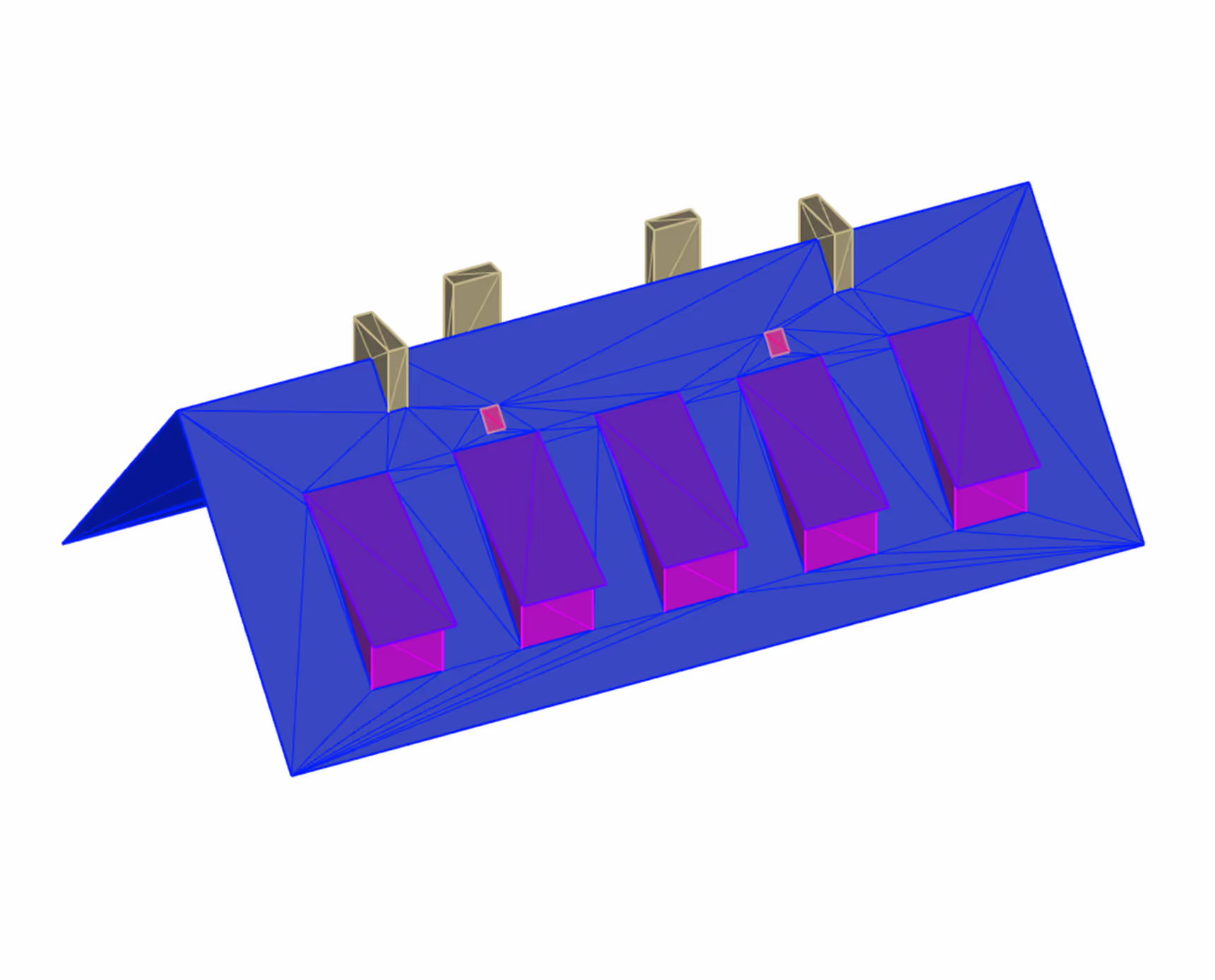
A true-to-scale 3D model of the building is automatically created from your drone images. Access data with centimeter precision without having to use complicated planning software yourself. Measure distances, areas and inclinations directly in the browser — from any device and with just a few clicks.


Transform 3D models into immediately usable planning data
The AI automatically converts your 3D model into exactly the data you need for your work. Whether measurement used by roofers, solar installers, solar engineers or standard-compliant documentation — you have all the necessary documents in minutes without manual post-processing. Export the data directly to your industry software and start planning and preparing offers immediately.
Start the measurement directly with our drone starter sets
Measure by a flight, plan precisely and create error-free offers — without complicated training or expensive special software. Choose the starter set that is perfect for your company size and requirements. In every package, you get everything you need to get started right away: drone, training, and access to the Airteam Fusion Platform.

How does Airteam AI work?


It's that easy
Create a new project with one click - without complicated setups or long forms. Can be used directly for your building measurement.
Capture all building dimensions with a single drone flight - whether by you, your team or an Airteam pilot. No more climbing, no more guessing, no more mistakes.
Transfer your drone images with just a few clicks and without any previous technical knowledge. The platform takes care about the rest.
In no time at all, your drone images become a standards-compliant 3D model with all relevant dimensions - while you take care of other tasks.
Access all important dimensions directly and export them for your measurement, PV planning or offer. No need for post-processing, no more hidden errors.