Calculate roof area: The 4 fastest methods 2025 - manual, online, software & drone


Calculate roof area: The 4 fastest methods 2025 - manual, online, software & drone
A precise roof area calculation is the basis for every successful roof project — whether for solar systems, roof repairs or renovations. According to data from the Bureau of Labor Statistics, 82.9% of all fatal roof worker accidents occur as a result of falls, slips, or trips, which makes manual measurements a significant safety risk. However, modern methods offer safe alternatives: from quick online calculations to Google Maps to professional drone surveys with DIN-compliant accuracy.
In this comprehensive guide, we compare four proven methods for calculating roof area — from traditional manual measurement to high-precision drone technology. You'll find out when which method is optimal, what costs arise and how you can make the right decision for your project.
Why an accurate roof area calculation is important
An inaccurate roof area measurement can cost your project dearly. With current European roof costs of €400-2,500 per square meter according to Roofit.Solar Even a 10% measurement error on a 100m² roof results in considerable additional costs.
The most common cost traps due to incorrect measurements:
• Waste of materials: Too many ordered bricks, insulation or PV modules
• Subsequent delivery costs: Additional transport costs in case of lack of materials
• Project delays: Downtimes due to incomplete material deliveries
• Rework: Expensive corrections to already installed components
For a typical German single-family house with a floor area of 100m², measurement errors can quickly lead to additional costs of €500-740, if you take into account waste of materials and additional working time.
The most common roof types in Germany
German residential buildings have various roof shapes, which have different measurement requirements:
• gable roof: Standard roof shape with two inclined surfaces
• hipped roof: Four inclined surfaces, complex in calculation
• Pent roof: Simple slope, easy to measure
• Flat roof: Minimum inclined area, simplest calculation
According to industry analyses, complex roofs with steep slopes can have twice as much surface area as flat roofs with the same base area, which makes precise angle measurements essential.
Method 1: Manual roof area calculation - formulas and step-by-step
Manual measurement requires safety equipment and mathematical understanding, but provides complete control over the measurement process. For small, simple roofs under 50m² with secure access It remains a viable option.
Equipment required for manual measurement
Basic equipment for safe roof measurement:
• Laser rangefinder: Basic models at around €47 with 120m range
• tape measure: For short distances and reference measurements
• Inclinometer app: Smartphone-based angle measurement
• Safety equipment: roof ladder, safety belt, anti-slip shoes
• documentation: sketchpad, camera for reference photos
Safety notice: Pro Tool Reviews shows that most laser rangefinders achieve an accuracy of around 3 mm at 10 meters, while tape measures are limited to ±1-2 mm — but both require access to dangerous roof areas.
Saddle roof calculation: The standard formula
The proven gable roof formula:
roof area = floor area/cos (roof slope angle × π/180)
Practical example of a typical single-family home:
- Floor area: 100m²
- Roof pitch: 45°
- cos (45°) = 0.707
- Result: 100m² ÷ 0.707 = 141.4m² roof area
The additional 41.4 m² due to the roof pitch corresponds to 41% more material and work required compared to the pure floor space.
hipped roof and more complex roof shapes
Wipped roofs require the calculation of all four sides individually — a time-consuming and error-prone task. Depending on the complexity of the roof, the manual measurement of complex roofs with dormers, multiple levels or irregular shapes can take several hours and poses significant safety risks.
When professional help is needed:
• Roofs over 100m² floor space
• Steep slopes over 30°
• Multiple roof levels or dormers
• Uncertain access conditions
Method 2: Google maps and free online tools
Satellite images provide quick estimates for planning phases, but have clear limitations when it comes to accuracy. Studies by the PMC National Center for Biotechnology Information show that Google Earth achieves a positioning accuracy of 39.7 meters RMSE, which is insufficient for precise roof calculations.
Google Earth area measurement - step by step
How to measure roof areas with Google Earth:
- Open Google Earth and enter the destination address
- Activate 2D view for better measurement accuracy
- Click ruler icon in the tool bar
- Select polygon tool for area measurement
- Trace roof contours by clicking on the corners
- Read the area in the information window
Important limitations:
• No roof slope considered: Google Earth cannot record roof slopes or angles and therefore only helps to calculate flat roofs.
• Weather-dependent image quality: Studies show that shadows and seasons influence measurement accuracy
• Outdated images: Satellite images can be months or years old
Online calculator for roof areas
Specialized PV calculators provide quick estimates based on basic parameters:
• PV*SOL Online: Floor area + roof slope = estimated PV area
• Solar calculator from the consumer center: Simple input fields for house data
• SolarEdge Designer: satellite image + manual adjustments
• Eturnity: Automatic roof area recognition with AI support
Accuracy range: Industry analyses show that online tools achieve ± 3% to ± 15% accuracy — sufficient for initial cost estimates, but unsuitable for final planning.
Method 3: Smartphone apps for roof measurement
Modern smartphones offer interesting measurement options, However, recent reviews from Pro Tool Reviews show that “augmented reality programs on smartphones are not yet precise enough for important survey tasks.”.
Tilt angle apps and AR measurement tools
Available app categories:
• Inclinometer: Smartphone gyroscope for determining the angle
• AR measurement tools: camera-based distance measurement (limited accuracy)
• Laser rangefinder apps: Only functional with additional hardware
Practical restrictions:
- Smartphone sensors do not achieve the precision of professional measuring devices
- Camera-based measurements are highly dependent on light and distance
- Complex roof structures overwhelm mobile AR algorithms
When you need professional drone measurement
Professional drone measurement is becoming a necessity for:
- DIN-compliant measurement requirements for official projects
- Safety-critical roof accesses
- Complex roof structures with multiple levels
- Time-critical projects with high accuracy requirements
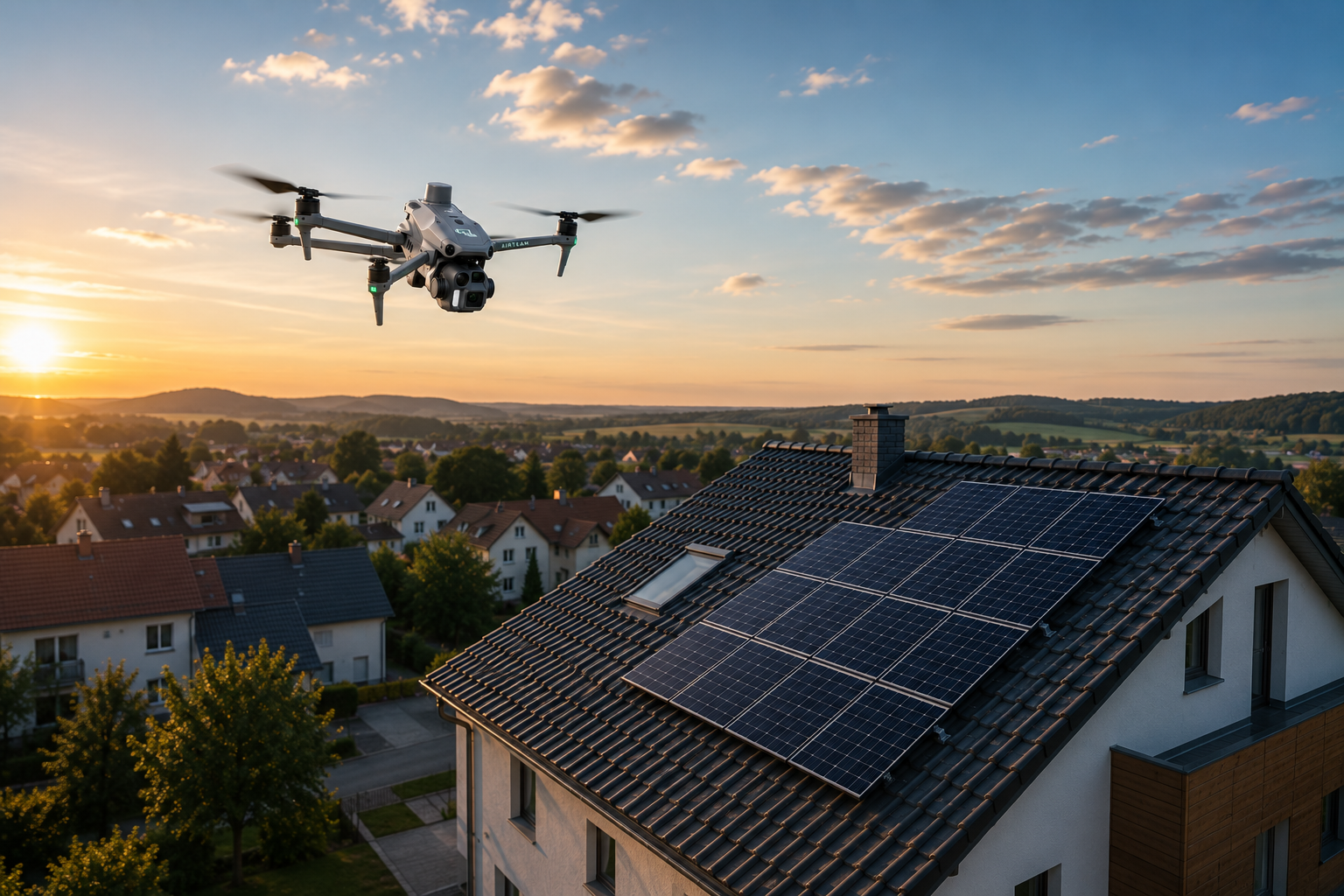
Safety comes first: When drones save lives
According to Bureau of Labor Statistics, 82.9% of all fatal roofing accidents occur as a result of falls, slips, or trips. Drone technology completely eliminates these risks, as workers can work on the project without having to get on the roof as often.”
Insurance benefits of drone surveying:
• No liability risks due to roof inspection
• Reduced risk of work accidents by almost 100%
• Documented security measures for proof of insurance
DIN-compliant accuracy for professional projects
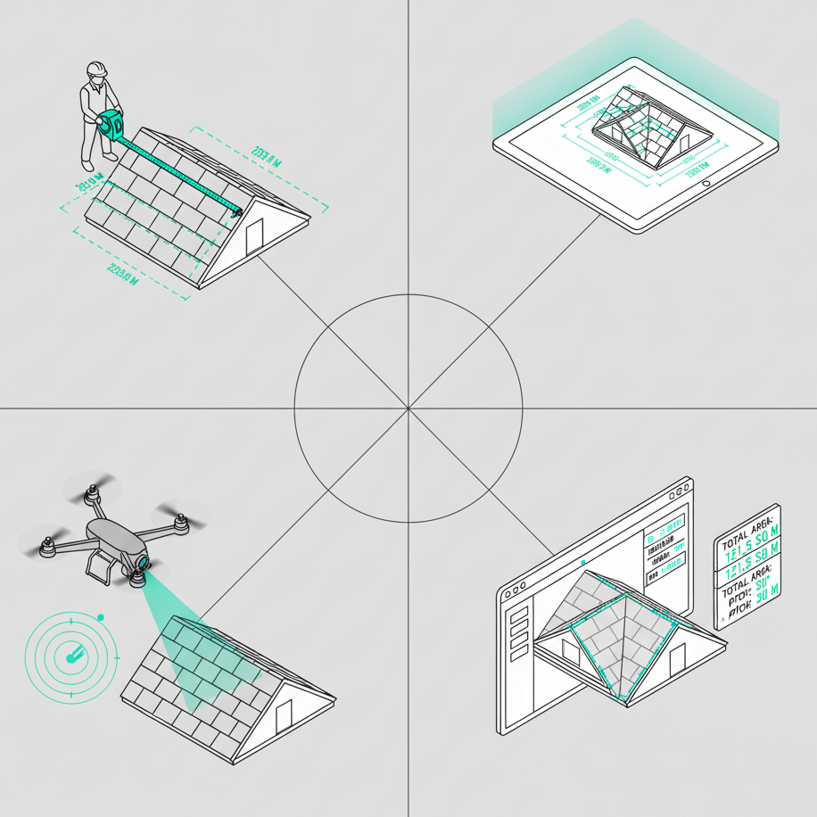
The official DIN SPEC 5452-5:2021 -11 defines standards for “digital roof measurement via drone” and, according to DIN Media, ensures that measurement results are “consistent and comparable.” Professional providers such as Airteam report accuracies of up to 99.9% with a 1-3 cm tolerance.
When DIN compliance is required by law:
• Official construction projects with approval procedures
• Insurance claims for roof damage
• Commercial tenders with documentation requirements
• PV systems with funding application documentation
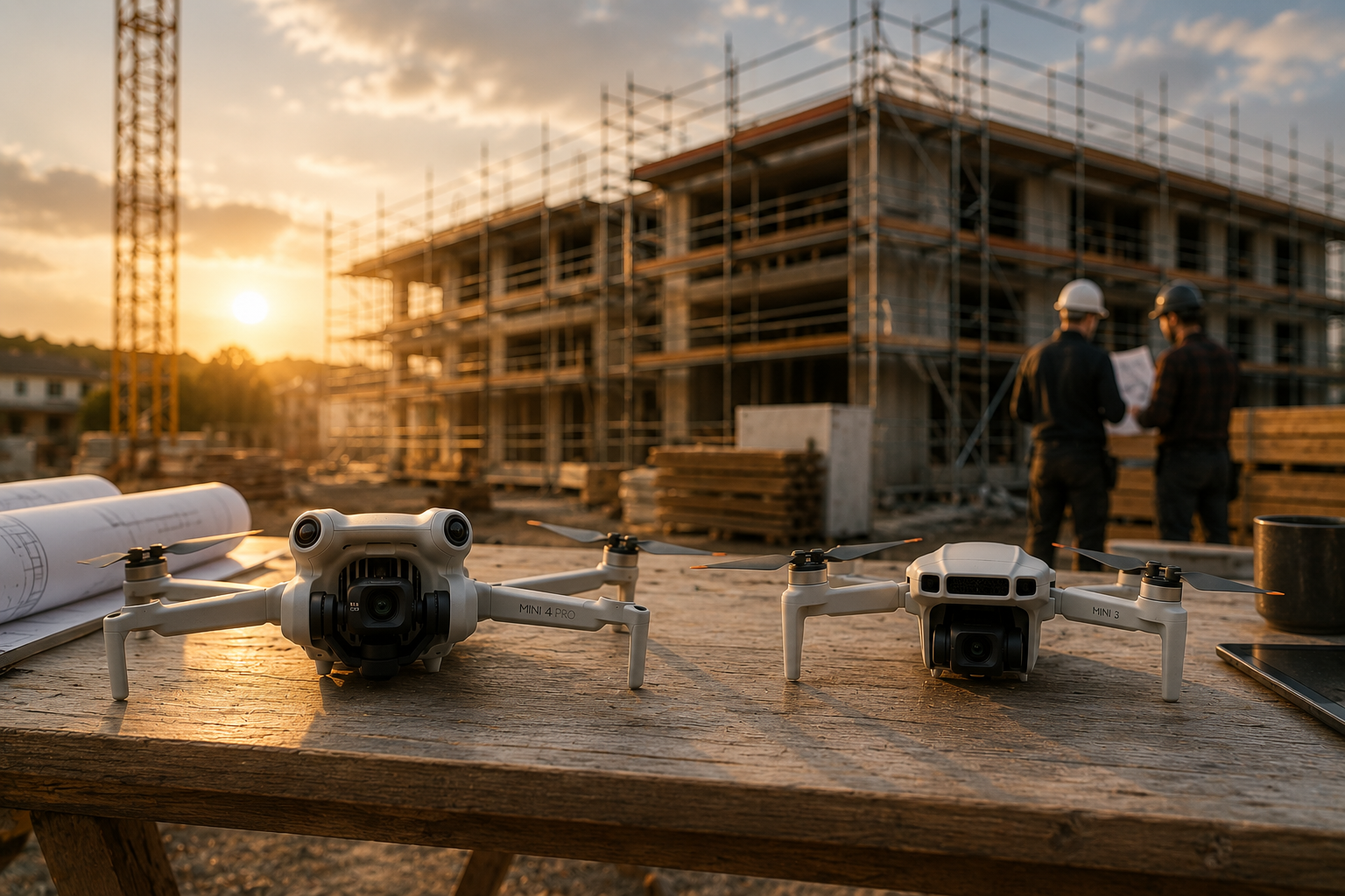
Airteam: The professional solution for precise roof measurements
As a leading provider of digital roof measurement, Airteam combines drone technology with AI-based evaluation. According to the company, over 5,000 companies already rely on 70,000+ successfully completed projects with DIN-compliant precision.
Increasing efficiency through automation
Customer reports such as those from Dachdeckerei Harnack show significant increases in efficiency: What used to require several hours of manual measurement, is carried out by drone technology in significantly shorter flight time plus automatic evaluation. That enables more measurements per week with greater precision at the same time.
Further customer testimonials according to Airteam:
• Dachdeckerei Mann GmbH: Customer-reported time savings and more offers won
• Lumoview Building Analytics: Significant cost savings and faster building registration
• Svea Solar: Reduced planning time and improved project costs
Integration with existing software
Airteam exports data to over 15 formats and integrates directly with leading industry software:
• PV planning: PV*SOL, Eturnity, SolarEdge Designer, PVCase
• Umbrella software: MF roof, SEMA, Solar Pro Tool
• CAD programs: AutoCAD, SketchUp (DXF/DWG)
• Scaffolding planning: Scaffmax for façade measurement
Workflow benefits:
- Direct data import without manual transfer
- Reduced transmission errors according to customer reports
- Seamless transfer between planning and execution
Cost comparison: DIY vs. professional surveying
A realistic cost analysis must include all factors: time, equipment, safety and risk of errors.
The true costs of manual measurement
Complete cost accounting for manual roof measurement:
• equipment: laser rangefinder (from €47), safety equipment (€200-500)
• Time required: Depending on roof complexity, several hours at typical German craftsman hourly rates of €40-60
• Security risk: Potential accident costs and liability
• Likelihood of error: Waste of materials and rework costs
ROI of professional drone measurement
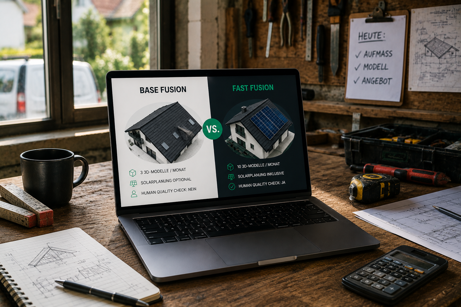
Airteam starter kits According to the 2025 price list, start at €1,950 including drone, training and a 2-month flat rate. If used regularly, the investment can be amortized by the following factors:
• Time savings: Significantly less measurement time = more billable projects
• Zero security risk: Eliminated risk of accidents and liability
• Precision: Fewer measurement errors = reduced rework
• Professional appearance: 3D visualizations can boost completion rates
Step-By-Step: Choose the Right Method
Use this Decision matrix for the optimal choice of method:
Decision matrix by project type
Select manual measurement when:
• Simple gable roofs under 50m²
• Safe, level access
• Unique projects without repetition
• Smaller budgets per project
Use Google Maps/online tools for:
• Initial cost estimates
• Flat roofs without critical accuracy requirements
• Preliminary discussions with customers
• Market analysis and potential studies
Professional drone measurement required for:
• DIN-compliant documentation requirements
• Complex roof structures (hipped roof, dormers)
• Safety-critical access conditions
• Repeating projects or portfolio digitization
FAQ - The most frequently asked questions about roof area calculation
How accurate are Google Maps measurements?
Studies by the PMC National Center for Biotechnology Information show that Google Maps provides rough estimates with 39.7 meters of RMSE position accuracy, But cannot detect roof slopes and therefore only helps with flat roofs. The satellite measurement accuracy of ± 3% to ± 15% is insufficient for final calculations. Google Earth is suitable for initial planning, not for precise material calculations.
What does it cost to offer professional drone measurement?
According to the Airteam 2025 price list, flat rates start at €125/month (Fast Fusion) up to €4,167/month (Ultra). Starter sets including drone costs €1,950-7.450 depending on the equipment. With regular use, the investment can pay off by saving time and eliminating measurement errors.
Which roof shape is the most difficult to calculate?
Complex roofs with steep slopes are the most challengingbecause, according to industry analyses, they “can have twice as much surface area as flat roofs of the same floor area.” Hipped roofs with four inclined surfaces, dormer roofs or irregular shapes overwhelm manual calculations and require professional measurement due to calculation complexity and safety risks.
Do I need DIN-compliant measurements?
DIN SPEC 5452-5:2021 -11 Compliance is required for official construction projects, insurance claims and professional documentation. The standard “defines standards for data formats, accuracies and processes” according to DIN Media and ensures that craft businesses receive “uniform and comparable results.” DIN compliance is often mandatory for commercial tenders and funding applications.
How quickly can I get measurement results?
Manual measurement: Immediate results, but several hours of work required depending on roof complexity. Online tools: Instant estimates with limited accuracy. Airteam drone survey: 3D model within 24 hours after upload, detailed planning data within 2-7 working days. The additional time required is compensated by eliminated measurement errors and rework.
Conclusion: Safety and accuracy come at a price
Choosing the right roof survey method depends on your specific requirements. While manual measurements are still practicable for simple projects, professional drone technology offers significant advantageswhen safety, precision and efficiency are paramount.
The clear advantages of professional drone measurement:
• Significant time savings compared to manual measurement
• Fewer measurement errors through AI-supported evaluation according to customer reports
• Zero security risk through ground-based data collection
• DIN-compliant documentation for professional projects
With over 82.9% of all fatal roofing accidents due to falls Does investing in safe surveying technology not only make economic sense, but also a question of responsibility towards employees.
For tradesmen, solar engineers and real estate companies who regularly implement roof projects, Airteam offers a combination of precision, efficiency and safety. You can make an appointment with Airteam here book for individual advice on your surveying requirements.
Source note: This article is based on research data from the Bureau of Labor Statistics, PMC National Center for Biotechnology Information, DIN Media, as well as manufacturer information and customer reviews from various providers. Cost figures relate to the German market as of 2025.