How accurate are roof measurements with drones


Drones are being used more and more frequently for roof inspections. What advantages do they offer and how accurate are roof measurements? Learn more now!
Using drones and AI together for accurate roof surveys
In the last decade, the measurement of house roofs and building facades has improved significantly. For many years, there was no other solution than to send someone up the ladder and take the measurements with a tape measure.
Thanks to rapid development in the field of drone equipment, accurate measurements are now possible with out-of-the-box drones.
What are the benefits of drones for roof surveys?
The main advantages of multicopters include their compact size and high maneuverability; flights close to buildings enable extremely high-resolution images. With this method, pilots can precisely measure different types of buildings.
The benefits of drones for roof surveying are:
- It saves time and money when creating measurements compared to manual measurement
- It is safer because you no longer have to get up on the roof for the measurement
- It is precise and provides reliable measurement results every time.
How does the measurement work?

- As soon as we receive an order, we check the flight conditions on site, coordinate with the homeowner and make an appointment.
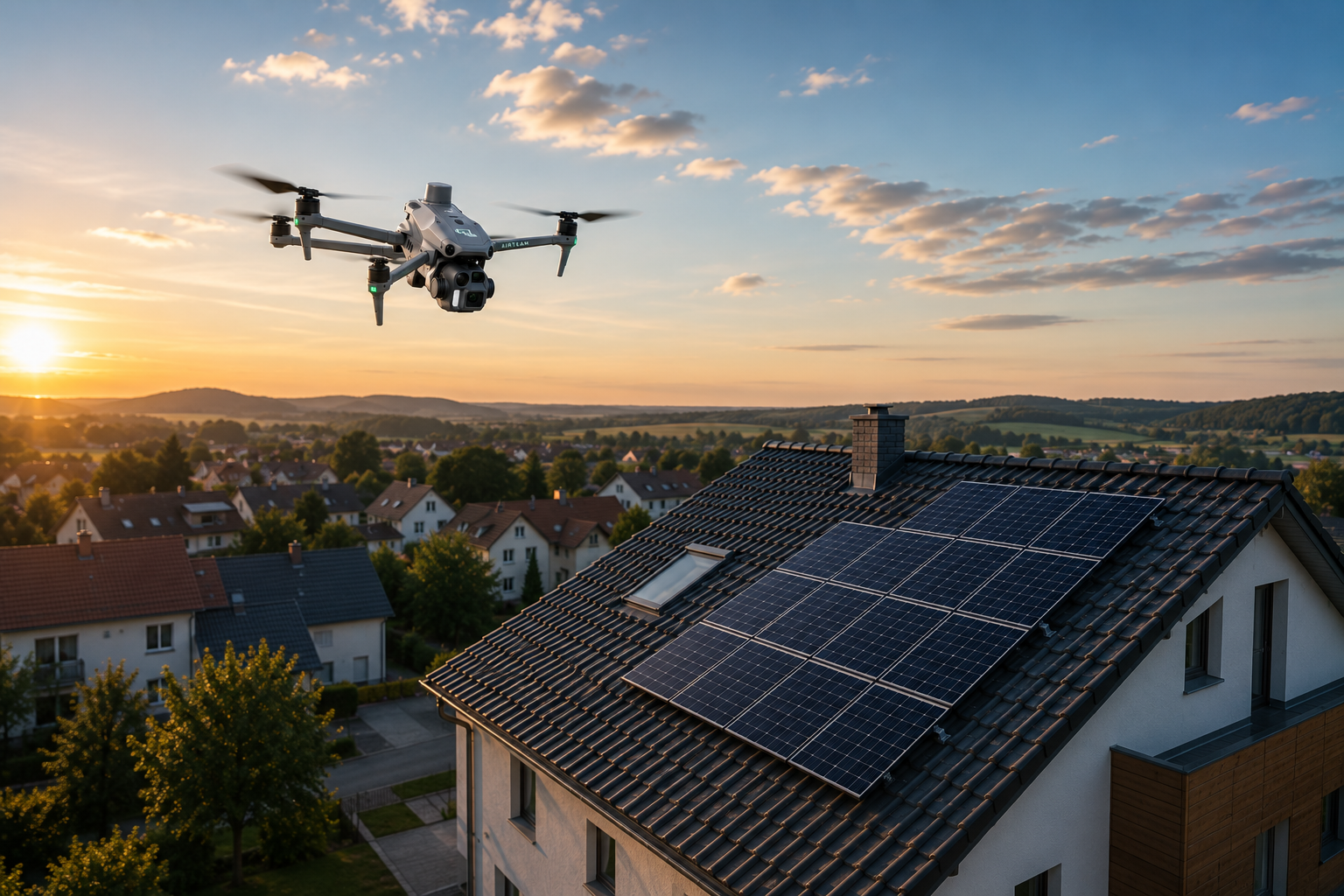
- One of our pilots carries out the drone flight on site and then sends the recordings to us for evaluation.
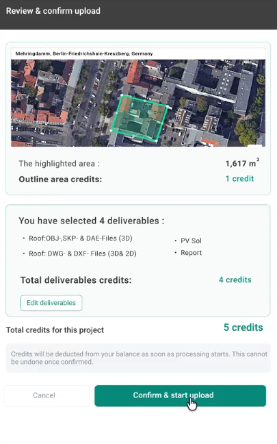
- Based on the images, we create a 3D model and provide you with a detailed report with all dimensions including dormers, chimneys, etc. In addition, you can receive the 3D model in all common formats.
We are currently working on exporting data directly to other software platforms.
High-resolution images for greater accuracy

As mentioned earlier, the ability to take pictures with very high resolution is one of the advantages of drones. The following overview shows the precision compared to other image sources:
- Satellite images: resolution of usually 30-50 cm per pixel
- Aerial photographs: resolution of usually 7-9 cm per pixel
- Drone images: resolution in the sub-centimeter range per pixel
With the help of such detailed images, even minor hail damage on a roof can be detected, for example. At the same time, we are able to make extremely precise roof measurements.
How accurate are drone roof surveys?
In September 2017, Haag Engineering took part in a independent study compared manual roof measurement with drone roof measurement. The result: Measurements with drones offer an accuracy of 99.4 percent.
Conclusion
Drones are not only faster, safer and more cost-effective when inspecting roofs, they also enable very precise roof measurements. Now directly here order.