PV system planning with drones: Precise solar planning from the air


PV system planning with drones: Precise solar planning from the air
Modern solar systems require precise measurements and comprehensive site analyses. Drone-based PV planning delivers accuracy down to the centimeter and carries out surveys 75-97% faster than traditional methods, revolutionizing the way solar professionals approach project planning and implementation.
Comprehensive drone-based PV planning services
Accurate roof measurement and analysis
RTK/PPK-enabled drones achieve an accuracy of 2 to 3 cm and thus provide the basis for reliable PV system planning. This precision meets or exceeds the requirements for professional solar planning applications. Traditional GPS drones offer positioning accuracy at the meter range, while RTK/PPK systems correct at the centimeter level.
Shading analysis and layout optimization
A comprehensive site analysis identifies potential shading issues that could affect system performance. Drone surveys make it possible to reduce the need for personnel to reach dangerous or hard-to-reach areas, and allow a thorough evaluation of complex roof geometries and surrounding obstacles.
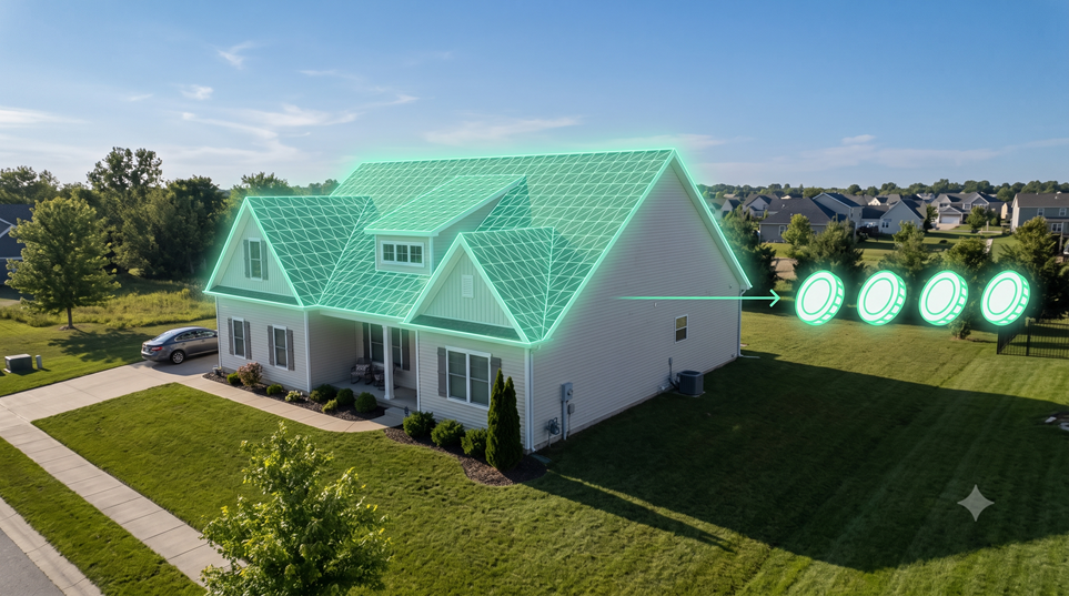
Module occupancy planning
Detailed 3D models support optimal module placement and system configuration. Professional photogrammetric processing takes multiple factors into account, including ground checkpoint placement, sensor resolution, and environmental conditions. This systematic approach ensures maximum energy yield and installation efficiency.
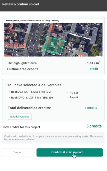
Technical documentation and planning documents
German PV installations must comply with DIN EN 62446-1 VDE standards, which define the necessary information and documentation for grid-connected PV systems. The standard specifies start-up tests, inspection criteria, and documentation to verify a safe installation. PV systems have expected lifespans of decades and therefore require appropriate documentation from the outset.
Benefits of drone-based PV planning
Superior accuracy
RTK drones provide centimeter-accurate positioning for photogrammetric applications and significantly exceed satellite-based measurements. Direct georeferenced results produce photogrammetric products with decimeter accuracy and ensure reliable data for system planning.
Dramatic time savings
Drone thermography takes around 10 minutes to measure a megawatt of power, while manual inspection requires 3 to 5 hours per MW. Technicians need around 25 hours to inspect 1MW on foot, while drones can fly over 1MW solar panels in just 10 minutes. This represents efficiency improvements of 75% to 97% compared to manual measurements.
Full capture
Traditional manual inspections typically capture just 10-25% of modules to save costs, while drones can inspect 100% of panels. This comprehensive coverage provides more reliable data for system planning and performance optimization.
Improved security
Drone surveys eliminate safety risks when sending personnel into harsh environments, particularly important for complex roofs and industrial plants. This reduces occupational accident risks and site safety incidents and contributes to overall project cost efficiency.
cost efficiency
According to industry studies, drone inspections save 1,066 euros per MW compared to conventional methods, with some analyses showing savings of up to 1,459 euros per megawatt. Conservative cost modelling suggests minimal savings of around 585 euros per MW, which makes drone-based planning economically attractive for most projects.
Your PV project in 5 steps
1. Initial consultation and site assessment
Project requirements analysis and flight planning ensure optimal data collection for specific site conditions and regulatory requirements.
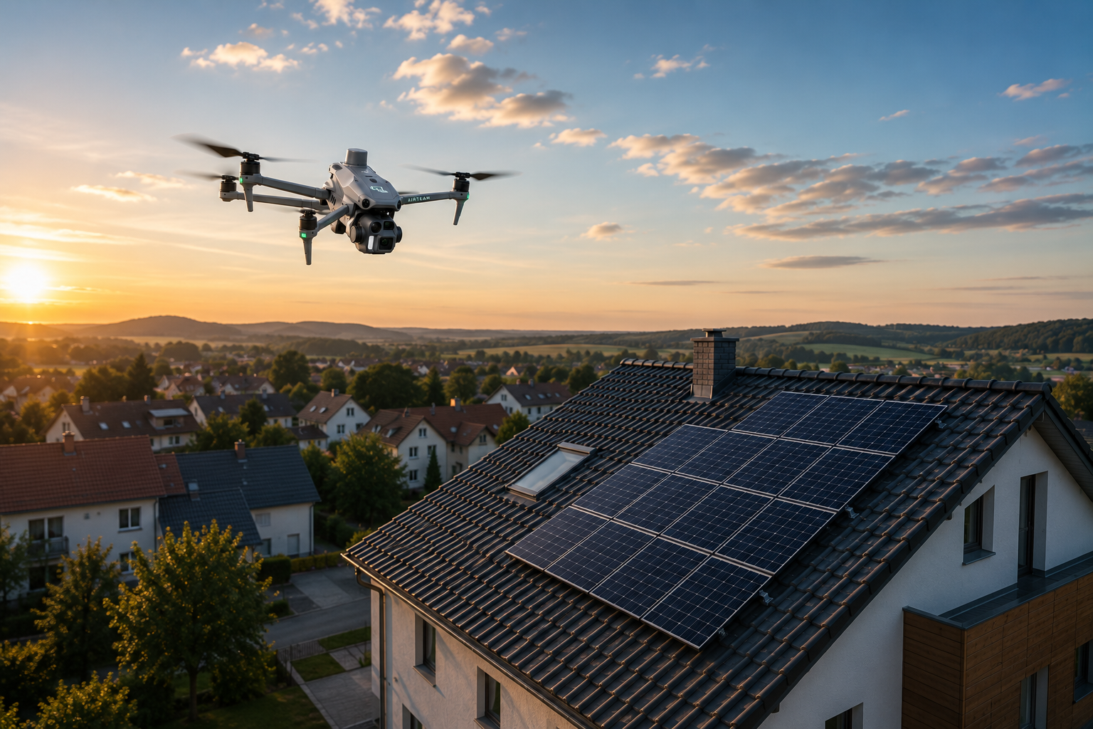
2. Professional drone measurement
Weather-dependent flights with RTK-equipped drones collect comprehensive location data. Most commercial drones have weather tolerances of 0°C to 40°C operating temperature, 10 m/s maximum wind speed and 0 mm/h precipitation tolerance.
3. Data processing and 3D modelling
Advanced photogrammetric processing via the Airteam Fusion platform creates accurate 3D models and planning data within 24 hours and ensures rapid project progress.
4. PV system design and layout
Detailed system configuration with industry-standard software integrations, including exports to PV*SOL, Eturnity and SolarEdge Designer platforms.
5. Handing over documentation
Complete planning documentation package that meets DIN standards and regulatory requirements for professional installation teams.
Key findings
- RTK-enabled drones deliver 2-3 cm accuracy for reliable PV planning data
- Time savings of 75-97% compared to manual measurement methods create significant project efficiency
- Cost reductions of 585-1,459 euros per MW make drone-based planning economically convincing
- Safety benefits eliminate dangerous roof access and ensure complete site coverage
Frequently asked questions
Q: How accurate is drone data for PV system planning? A: RTK/PPK-enabled drones achieve 2 to 3 cm accuracy, which meets or exceeds the requirements for professional PV planning applications and significantly exceeds satellite-based measurements.
Q: What are the cost benefits of drone-based PV planning? A: Industry studies show savings of 1,066-1,459 euros per MW compared to traditional inspection methods, with conservative estimates suggesting minimal savings of around 585 euros per MW for most projects.
Q: How much faster are drone surveys compared to manual methods? A: Drones can do in 10 minutes what technicians need manually 25 hours, which means time savings of 75-97% for comprehensive site surveys.
Q: What weather conditions limit drone operations? A: Most commercial drones require 0°C to 40°C temperatures, wind speeds below 10 m/s and 0 mm/h precipitation. Weather dependency requires flexible scheduling, but affects traditional surveying methods in a similar way.
Speed up your PV projects with professional drone planning
Transform your solar installation workflow with Airteam's proven drone-based planning platform. Our AI-powered photogrammetry pipeline delivers DIN-compliant 3D models and planning data within 24 hours and integrates seamlessly with PV*SOL, Eturnity, and other industry-standard design tools. Join 5,000+ companies that are already using professional drone planning to win more offers with risk-free calculations and speed up project times.
sources
- https://pointonenav.com/news/drone-rtk/ - (accessed 2025-09-03)
- https://www.tandfonline.com/doi/full/10.1080/10095020.2019.1710437 - (accessed 2025-09-03)
- https://www.ncbi.nlm.nih.gov/pmc/articles/PMC7219658/ - (accessed 2025-09-03)
- https://www.jouav.com/blog/rtk-drone.html - (accessed 2025-09-03)
- https://energycentral.com/c/cp/drones-reduce-solar-om-costs-1254-mw - (accessed 2025-09-03)
- https://averroes.ai/blog/how-much-does-drone-solar-panel-inspection-cost-2024 - (accessed 2025-09-03)
- https://thedronelifenj.com/the-ultimate-roi-guide-for-infrared-drone-solar-inspections/ - (accessed 2025-09-03)
- https://60hertzenergy.com/drone-thermography/ - (accessed 2025-09-03)
- https://thedronelifenj.com/uses-for-drones-in-the-solar-industry/ - (accessed 2025-09-03)
- https://www.aviationoutlook.com/solar-panel-inspection-drone/ - (accessed 2025-09-03)
- https://www.nature.com/articles/s41598-021-91325-w - (accessed 2025-09-03)
- https://www.vde-verlag.de/standards/0100516/din-en-62446-1-vde-0126-23-1-2019-04.html - (accessed 2025-09-03)
- https://xpsurveys.co.uk/drone-surveys-vs-traditional-land-surveying-which-is-more-accurate/ - (accessed 2025-09-03)