Why the DJI Matrice 4E is the perfect choice for building surveying
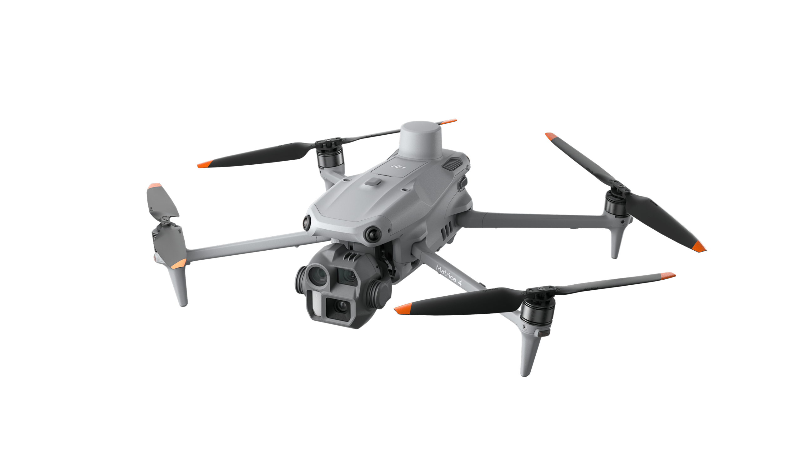


What if you could precisely capture an entire commercial building or an extensive solar park in just one flight — with an accuracy that significantly exceeds traditional measurement methods? That is exactly what the DJI Matrice 4E is for done. The drone was specially designed for geospatial applications such as surveying, mapping and construction planning and sets new standards in professional drone surveying.
For roofers, solar installers, carpenters and scaffolders, who regularly need accurate building data, the question is no longer whether Drone measurement makes sense — but With which system You work. This article explains why the Matrice 4E combined with the Airteam Fusion platform is one of the most powerful solutions for professional 3D building surveys.
What sets the Matrice 4E apart from other survey drones
The Matrice 4E is designed from the ground up for geospatial applications such as surveying, mapping and construction projects. Their equipment is consistently designed to increase efficiency, repeatability and precision in everyday work.
In contrast to typical consumer models or simple enterprise drones, the Matrice 4E is a specialized work tool for professionals. As a further development of the Matrice 3E, it combines high-resolution camera technology with modern RTK positioning and thus enables fast, precise data collection in real time.
Three key features make them particularly interesting for building surveying:
- Integrated RTK module: Accurate positioning straight out of the box, without a separate base station
- Versatile multi-sensor camera system: Wide angle, medium focal length and 7x zoom combined in one gimbal
- AI-powered Smart 3D Capture: Automated flight routes and image recordings even for complex buildings
Technical strengths of the Matrice 4E in detail
Precision thanks to integrated RTK
The integrated RTK module forms the core of the Matrice 4E. In RTK fix mode, the system achieves a horizontal accuracy of 1 cm + 1 ppm and a vertical accuracy of 1.5 cm + 1 ppm. The ppm value corresponds to an additional error of approximately 1 mm per kilometer of measurement distance. In practical terms, this means that even on larger projects and across wide areas, the data remains accurate to the centimeter, significantly reducing the need for manual post-processing.
On this basis, precise orthophotos, maps and digital terrain models can be created without having to plan complex post-processing steps.
Camera system for photogrammetry and inspection
For actual data collection, the Matrice 4E uses a powerful 4/3 inch CMOS sensor with 20 megapixels. The high resolution provides detailed aerial images and creates the basis for reliable photogrammetric evaluations in surveying and mapping.
An important advantage over simpler systems is the mechanical lock. It minimizes rolling shutter effects and motion blur, even at higher flight speeds, and thus ensures reproducible image quality.
For inspections, there is also a Dual telephoto camera system available with up to 7x lossless zoom. This allows you to check components, connections or potential damage in detail from a safe distance. Ideal when safety distances must be maintained and razor-sharp images are still required.
Laser rangefinder: precise measurements at the push of a button
One frequently underrated tool on the Matrice 4E is the integrated laser rangefinder. It makes it possible to determine distances, altitudes and specific object points directly during the flight, eliminating the need for additional measuring devices or manual calculations.
This has noticeable advantages, especially during inspection missions or during an initial inventory:
- Exact determination of distances to facades, roof closures or obstacles, for example
- Quick spatial orientation on complex buildings
- Direct plausibility check of photogrammetry data already on site
For craft businesses, this means that you can make reliable statements about dimensions and situations even during the flight, even before the complete 3D model is available.
Electronic defogging: Clear data in difficult conditions
In practice, weather conditions are rarely ideal. This is where the Matrice 4E's electronic defog comes into its own. Image processing automatically adjusts contrast and clarity to improve image quality when:
- nebula
- haze
- high humidity
- critical lighting conditions
This creates significantly more usable image data sets, which is directly reflected in more precise 3D models and inspection results. This is particularly relevant for assignments:
- early in the morning
- in the autumn and winter months
- in industrial environments with dust, steam or smoke
Flight time and area coverage
With a flight time of up to 49 minutes per battery and a maximum flight speed of 21 m/s, the Matrice 4E can capture up to 2.8 km² in a single flight. This means that even large industrial roofs, commercial areas or solar parks can be efficiently documented in one operation.
At the same time, the system remains handy and mobile with a take-off weight of around 1.2 kg. Ideal for teams that frequently change locations.
Smart 3D Capture: Building measurement largely automated
One of the most important functions for everyday surveying is the Smart 3D Capture function. It aims to automate the entire process for creating 3D models as much as possible.
Using the remote control, you first create a rough model and mapping routes based on it. As a result, even irregular or complex building structures are reliably covered.
The process in practice: The Matrice 4E first carries out a short reconnaissance flight, creates a first point cloud from it and automatically derives an optimized flight route. The actual survey flight is then fully automated, with a defined distance from the building surface and images taken from several angles.
The result: Noticeably less manual effort combined with very high GSD accuracy, ideal for digital twins and detailed inspections.
For companies that require exact 3D roof dimensions, this means: lower pilot experience requirements, reproducible results and significantly shorter time spent on the construction site.
The Matrice 4E with Airteam: The Max Fusion starter set
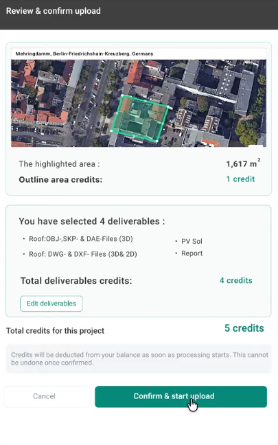
The Matrice 4E develops its full potential in conjunction with Airteam Fusion platform. Certified 3D building models are automatically generated from the captured images, typically within less than 24 hours, with an accuracy of up to 99.9% according to DIN standards and a tolerance of 1—3 cm at a flight altitude of 40 m.
that Max Fusion starter kit from Airteam bundles all components for direct access:
- DJI Matrice 4E including RTK module and Pro controller
- Robust transport and construction site case plus two additional batteries and charger
- Airteam Fusion Software for automated 3D model generation
- Comprehensive briefing and training (online and on-site)
Airteam flat rates allow you to flexibly adjust usage: Regardless of whether you regularly process projects or process individual large objects, your effort scales with your needs.
Who would particularly benefit from the Matrice 4E?
The Matrice 4E is particularly interesting if you:
- Regularly large areas must include (e.g. commercial real estate, solar parks, residential areas)
- High measurement accuracy requirements Have (for example for PV planning, scaffolding or BIM projects)
- Complex roof and building structures worked with many dormers, jumps and special shapes
- Combine measurement and inspection Would like (e.g. area measurement plus detailed check with 7x zoom)
- Einen scalable, professional workflow want to establish for recurring assignments
Maximum flight safety: For use on real construction sites
On construction sites, in addition to accuracy, one thing counts above all: safe processes. The Matrice 4E has a modern obstacle detection system that works all around and thus significantly reduces the risk of collisions.
In practice, this means:
- Early detection of scaffolding, facades, pipes and other obstacles
- Stable flight position even in narrow or confusing areas
- Less risk of damage to drones, buildings or the environment
The whole thing is supported by intelligent flight modes and redundant systems. In this way, even less experienced pilots can carry out safe flights and deliver repeatable results, an important point for companies without their own drone team.
High usability in demanding environments
The Matrice 4E is built for real conditions and not just for fair-weather flights. The robust construction and flight control ensure reliable results even in demanding scenarios:
- High wind stability
- Secure data and signal transmission even in densely populated areas
- Accurate position even close to the building
This makes it particularly suitable for:
- inner-city survey projects
- complex industrial plants
- large construction sites with numerous sources of interference
Conclusion: More efficiency, higher precision, more safety
The DJI Matrice 4E is not a universal leisure multicopter, but a specialized tool for measurement. Integrated RTK, Smart 3D Capture, up to 49 minutes of flight time and the flexible multi-sensor camera system make it a powerful tool for precise building data collection from the air.
In conjunction with the Airteam Fusion platform, the raw images automatically become complete, DIN-certified 3D building models, which can be transferred directly to your planning tools. The results are significantly reduced project runtimes, no more dangerous roof inspections and meaningful offers that enable you to professionally position yourself with your customers.