Roof inspection rethought: drone vs. satellite vs. aircraft images — The ultimate comparison 2025
.jpg)


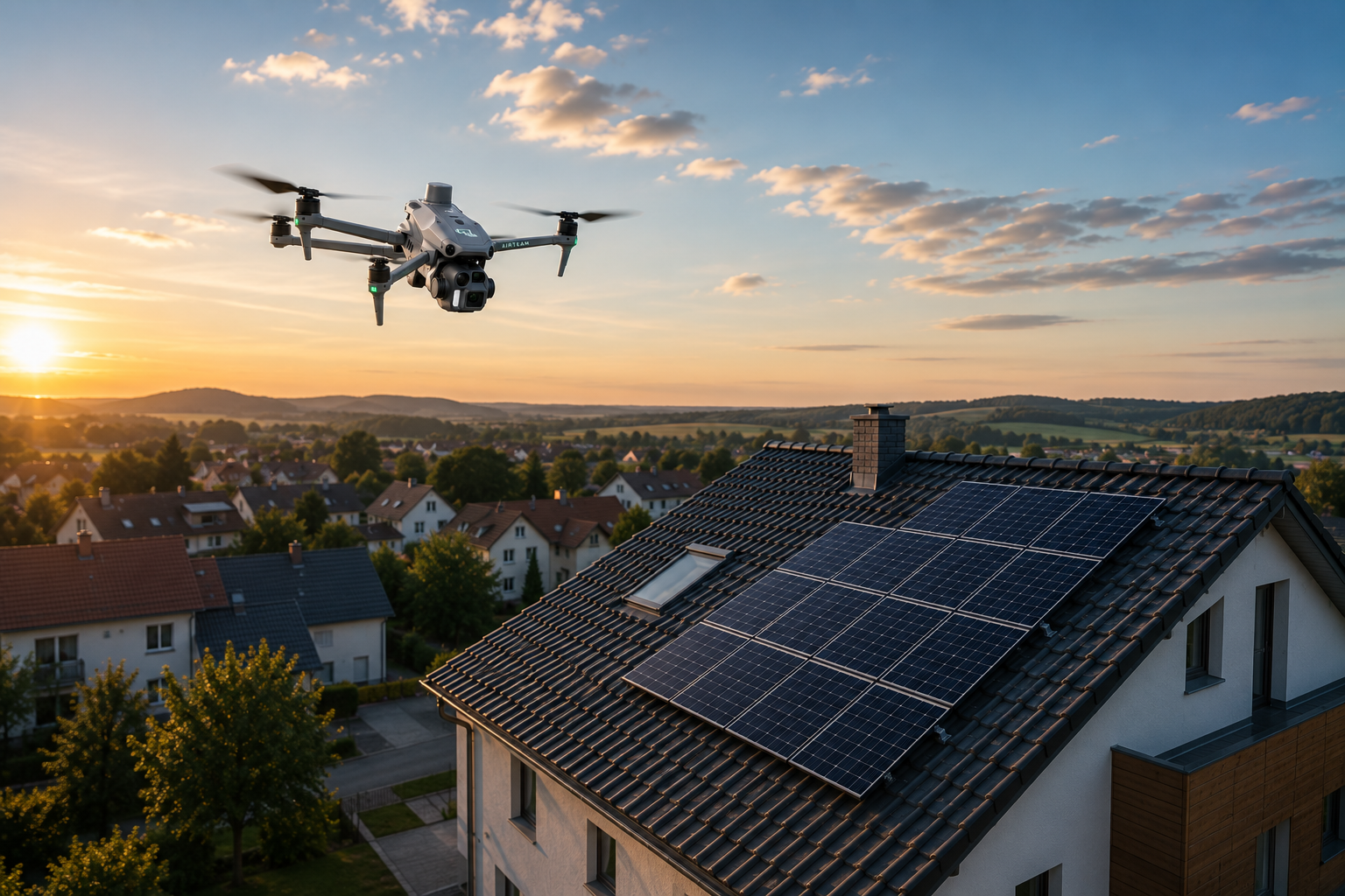
Drone measurement achieves precision down to the centimeter and reduces accident risks to almost zero. There are now three digital ways of roof inspection available for German craftsmen: drone measurements, satellite images and aircraft images. While satellite data appears inexpensive but, with deviations of 50 cm or more, is useless for precise calculations, drones are the clear winner — with DIN-compliant accuracy of up to 99.9% and enormous safety benefits.
The construction industry is one of the most accident-prone sectors in Germany, with crashes as one of the most common causes of accidents. This is one of the reasons why the drone inspection market is growing at an annual growth rate of 14.2% between 2023 and 2033, according to Fact.mr.
The three ways to digital roof inspection — An overview
Three technologies are competing for the future of roof measurement: drone imaging, satellite images and aircraft photography. Each method has different strengths in accuracy, cost, speed, and practical application for roofers, solar installers, and carpentry businesses.
drone survey uses unmanned aerial vehicles (UAVs) with integrated GNSS receivers to collect geodata from above. The sensor type (RGB camera, multispectral, or LiDAR) determines the data collection and the resulting outputs.
satellite images are high-resolution images of building roofs from space, which are often used to inspect and assess the condition of the roof.
Airplane photos use manned aerial vehicles such as airplanes and helicopters as traditional platforms for aerial image data collection. They offer larger coverage areas and can carry heavier payloads.
Studies show that commercial drones in Germany are primarily used for surveying and inspection activities. Europe is leading the global market for drone roof inspection and achieved a market share of over 30% in 2023.
Satellite images — The free standard with hidden costs
Satellite images appear inexpensive, but cause significant follow-up costs due to inaccuracies. Research studies on Google Earth checkpoints show a positional accuracy of around 40 meters RMSE, with error ranges of less than one meter to over 170 meters. Accuracy typically ranges from ± 3% to ± 15%, depending on image resolution, roof complexity, and slope.
Main problems with satellite measurements
- Extreme inaccuracies: Deviations of 50 cm or more are normal; in exceptional cases, deviations of several hundred meters may occur
- Outdated data: Satellite images are often out of date and do not show any new buildings or changes to the roof
- 2D presentation without slope information: Satellite data does not record roof slopes or three-dimensional structures required for precise material calculations
- Distortions due to slanted shots: Satellite image tiles are not always precisely oriented, which means that significant deviations are possible in exceptional cases
Industry studies show that, before using professional roof survey reports, roofers required additional supplies of materials for almost half of all projects and returns for over a third. After switching to professional reports, these problems were drastically reduced.
Satellite images are only suitable as basic guidelines and starting points, but craftsmen must take into account changes since they were taken and remember that minor changes may not yet appear in the images.
Airplane photos — more precise but more expensive and complex
Airplane photography offers better resolution than satellites, but is significantly less accurate than drone data. Manned aircraft operate at higher altitudes and cover extensive areas more quickly. However, this may result in lower resolution, although it may be sufficient for projects with less demanding accuracy requirements.
Disadvantages of aircraft measurement
- High logistics costs: Requires trained pilots, aircraft maintenance, investments in aircraft rental, and permits to fly in restricted airspace
- Weather dependence: Flight planning must take harsh weather conditions into account and is significantly more weather-dependent than drone flights
- Longer lead times: Aircraft surveys require extensive flight planning, scheduling and regulatory approvals
- Economical only for major projects: For large-scale mapping or regional data collection with extended coverage in a single flight, manned aerial vehicles can be more cost-effective
Drone lidar can capture higher resolution data due to the ability to fly at lower altitudes. Manned aerial vehicles operate at higher altitudes, which can result in lower resolution.
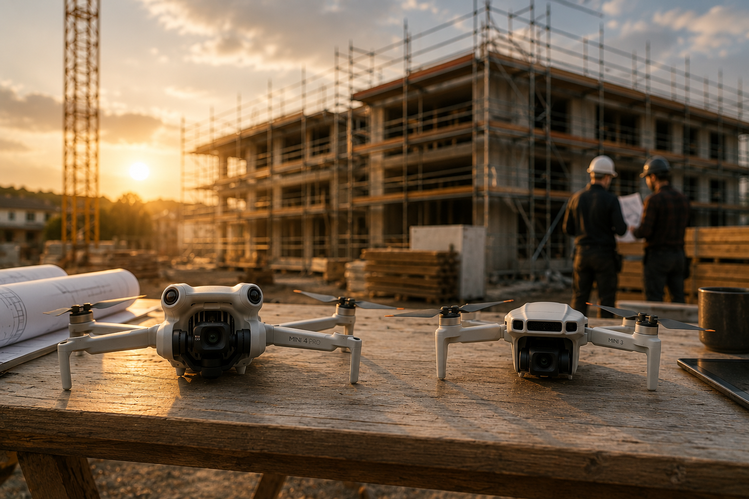
Drone Surveying — The Future of Precise Roof Inspection
Drone measurement achieves DIN-certified accuracy of up to 99.9% with tolerances of just 1-3 cm over 40 meters. Professional drone photogrammetry achieves horizontal accuracy of up to 1 cm, with vertical accuracy typically being half to a third as good. Studies confirm 2—5 cm horizontal and 3—6 cm vertical accuracy with RTK/PPK plus control points.
Benefits of drone technology
- Extreme time savings: Measurements in 5 minutes instead of 1 hour using traditional methods, with enormous safety gains for the PV industry and increased productivity
- Accurate measurement to the millimetre: Precise recording of roof surfaces and structures minimizes sources of human error, GPS and precision technologies ensure accurate and repeatable measurements
- Minimal risk of accidents: The risk of accidents at work is reduced to almost zero compared to direct roof access
- Immediate availability: A single drone flight records all required measurements in 10 minutes instead of hours. Cloud software automatically creates finished 3D models from drone images
- German legal compliance: Insurance is required for commercial operations. Liability insurance with sufficient coverage is mandatory for all private and commercial drone flights in accordance with German regulations
Drone roof inspections typically cost €80-150 per flight hour, while traditional methods cost €75-200 per inspection. Processing raw LiDAR data takes just a few minutes to calibrate the final point cloud, while photogrammetry processing can take significantly longer than the survey itself.
Accuracy in detail comparison — centimeter vs. meter vs. uncertainty
Drones offer significantly higher accuracy than satellite data at comparable costs. The differences in accuracy between the three methods are dramatic and have a direct impact on material calculations and project costs.
During a drainage study at Chennault International Airport, project manager Andrew Milanes explained: “This project could not have been replicated using traditional measurement techniques. It would have taken weeks or months to obtain this data — and even then, the quality would not have been up to what we have now.” Data with verified absolute horizontal accuracy of 1.5 cm now form the basis for hydrological modelling and master plan revisions.
The differences in accuracy have direct financial consequences: Inaccuracies in satellite data can result in significant additional material handling costs and time delays for corrections.
Cost-benefit analysis — What really pays off?
Drone measurement pays off after just a few projects. Industry analyses show that investments in drone systems and corresponding software pay off within 2-3 projects. Most companies achieve a corresponding return on investment.
Hidden costs of various methods
Satellite data:
- Seemingly available “for free” via Google Maps
- High follow-up costs due to frequent rework
- Time lost due to manual corrections and recalculations
- Liability risks in case of inaccurate offer preparation
Airplane photos:
- High direct costs for aircraft rental and pilots
- Long lead times delay projects
- Weather-related outages increase planning costs
- Economically viable only for major projects
Drone survey:
- Moderate initial investment for starter sets
- Monthly software subscriptions starting at low three-digit amounts
- Up to 45% shorter project duration and significant cost savings
- Drastically reduced insurance costs due to fewer on-site risks
The construction industry traditionally has higher occupational accident insurance rates than other industries. Around a fifth of all workplace accidents occur in the construction sector.
Practical application — this is how it works in everyday crafts
A single drone flight records all measurements in just a few minutes instead of hours. The workflow is optimized for tradesmen and requires no CAD expertise.
Step-by-step process for drones
- Capture (5-10 minutes): A single drone flight records all required measurements in just a few minutes
- Automatic processing (24 hours): Cloud software automatically creates finished 3D models from drone images
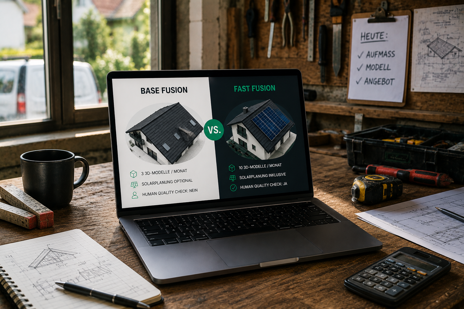
- Export (1-2 minutes): Direct transfer to industry-standard planning software such as MF Dach, PV*SOL, SEMA or AutoCAD
- Preparation of an offer (15 minutes): Generate professional offers with exact measurements
Integration with existing software
Modern solutions export to over 15 file formats and integrate seamlessly with common industry software:
- Roofing contractor: MF Dach, CSV export for material lists
- Solar: PV*SOL, Eturnity, SolarEdge Designer, Sunny Design
- Carpentry: SEMA, SketchUp, AutoCAD, DWG/DXF
- Scaffolding: ScaffMax-compatible façade measurements
The typical workflow steps and time requirements differ dramatically between methods. Drone flights have defined steps and time requirements, while satellite and aircraft methods require more complex workflows.
Who is which method suitable for?
Drones are the ideal solution for most German craft businesses. The decision matrix is based on project size, frequency, accuracy requirements, and budget.
Target group recommendations
🏠 Roofer: Drones for DIN-compliant measurements and secure quotation preparation. Work accident insurance for roof projects is significantly more expensive than for office work.
☀️ Solar installers: Drones for fast roof models and PV planning exports. Direct export to standard planning software significantly speeds up the planning process.
🏗️ Carpentry: Drones for precise roof geometry and CAD integration. Millimeter accurate data reduces planning errors during prefabrication.
🚧 Scaffolding: Drones for façade measurements without on-site appointments. Reduces travel costs and speeds up the preparation of offers.
Exceptions for alternative methods
Satellites only with:
- Rough initial assessments without accuracy requirements
- Overview cards for marketing purposes
- Historical comparisons (with an awareness of inaccuracies)
Planes only with:
- Large-scale mapping of several square kilometers
- Budgets over 50,000€ for individual projects
- Special LiDAR requirements for large projects
FAQ — The most common questions about roof inspection
How accurate is a drone survey really?
Professional drone systems achieve DIN-certified accuracy of up to 99.9%, which in practice means deviations of often only 1-3 cm over 40 meters. Studies confirm horizontal accuracy of up to 1 cm and vertical accuracy of 3-6 cm.
How much does a roof survey by drone cost?
Drone roof inspections typically cost 80-150 € per flight hour. Thanks to huge time savings of up to 45% shorter project duration and significant cost savings, drone surveying is more cost-effective in the long term than traditional methods.
Do I need a drone license?
In Germany, appropriate documentation is required for commercial drone flights, and liability insurance with sufficient coverage is mandatory under current regulations. Many providers offer complete starter kits with training.
How dependent are drone flights on the weather?
Drones cannot be used in strong wind or rain, but are less dependent on the weather than aircraft photos. Most drone flights can be carried out in normal weather conditions.
Can I import the data into my existing software?
Modern solutions export to over 15 file formats and integrate with common industry software such as MF roof, PV*SOL, SEMA, SketchUp, AutoCAD and many more.
Conclusion — drones set a new standard for roof inspection
Drones have established themselves as the leading solution among digital inspection methods. With DIN-certified accuracy of up to 99.9%, significantly higher precision than satellite data and drastically reduced safety risks, they offer an ideal solution for modern craft businesses.
According to Fact.mr, the German market for drone inspections is growing at 14.2% annually, while the use of commercial drones has more than doubled in recent years. This development reflects the clear advantages: From the significant safety risks of direct roof access to almost risk-free measurement from the ground.
The investment pays off after just a few projects, while the significant time savings and the reduction of material defects sustainably strengthen the competitiveness of German craft businesses. A development that German craftsmen should not miss out on. With DIN-compliant standards, seamless software integration and proven success stories, drones are ready to shape the future of roof inspection.
With Airteam Starter sets can roofers, carpenters and solators immediately offer professional roof inspections.