3D Building Measurement with Drones: Here's How It Works in 5 Easy Steps


Step 1: Create a project and plan a flight (approx. 5 minutes)
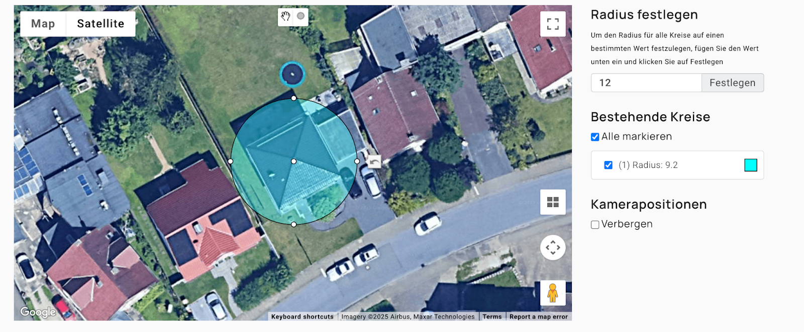
The first step is simply to mark the building on the map. The Airteam platform then automatically creates an ideal flight route for the drone. All relevant roof areas are taken into account — without manual planning.
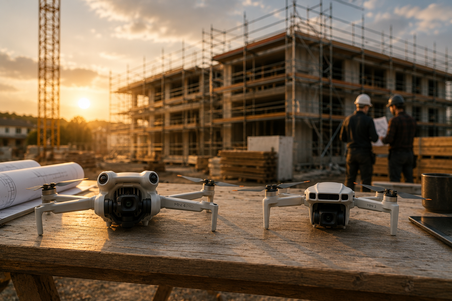
Step 2: Data collection on site (approx. 5—15 minutes)
There are two options on site:
- Use your own drone: With most commercially available drones (e.g. from DJI), the flight can be carried out automatically.
- Book an Airteam pilot: Alternatively, certified professionals take over data collection on site.
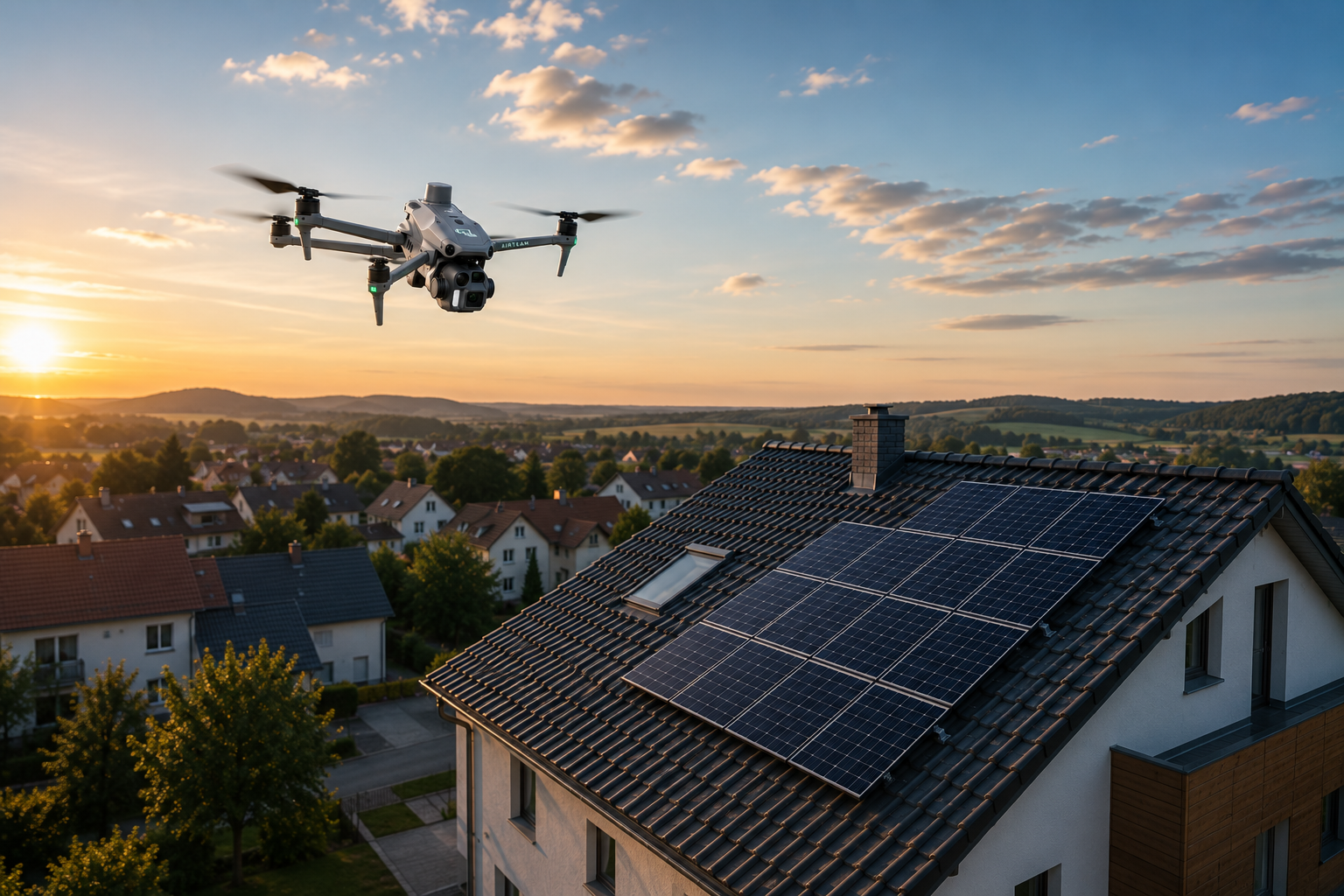
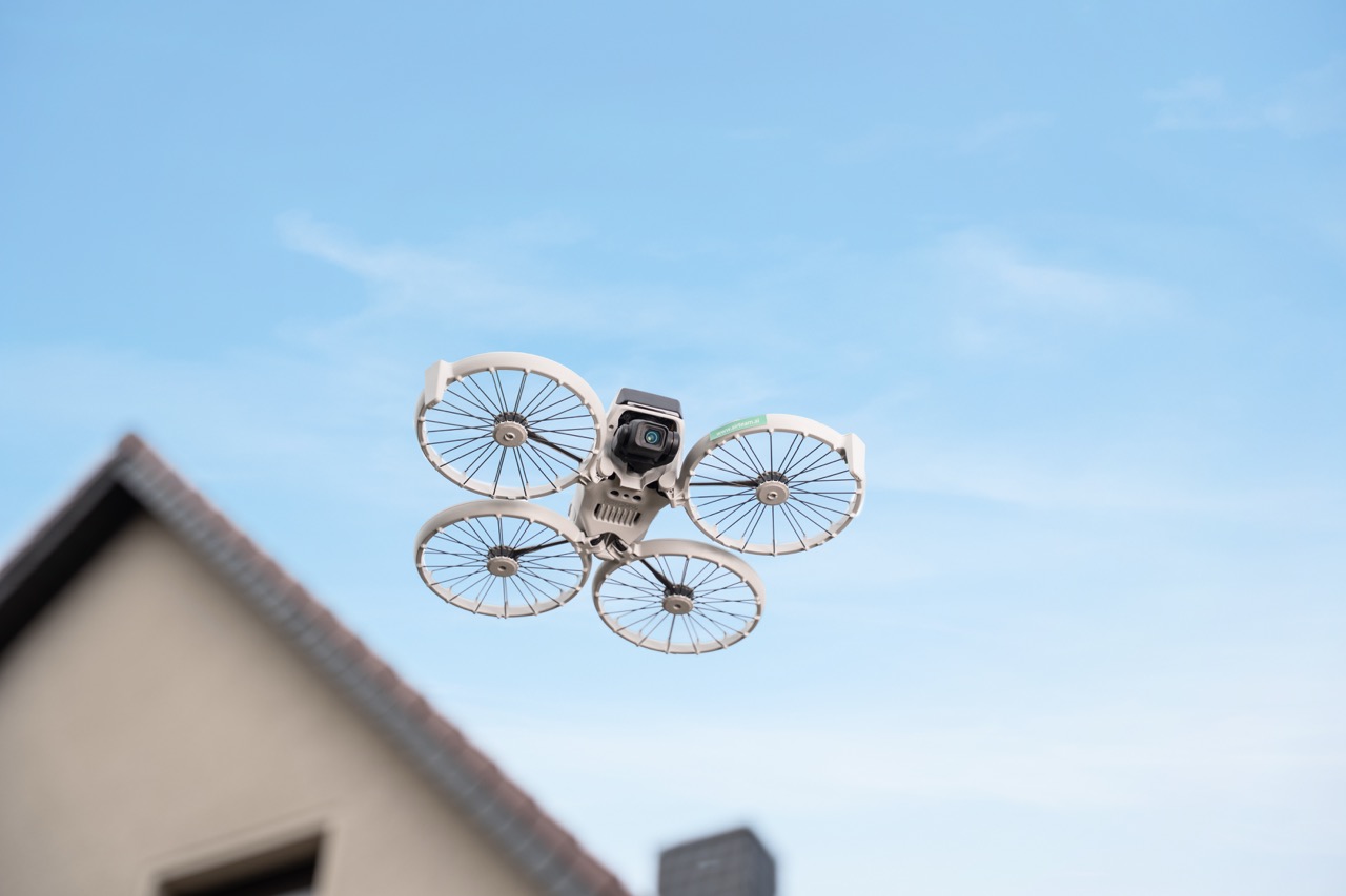
Just one DJI Flip is enough for roof measurement — with the hyperlapse circle mode, it enables an automated flight around the building, completely without manual control. The flight takes around 3 minutes for single-family homes and covers the roof and façade from all relevant angles.
You can find a free guide here in video.
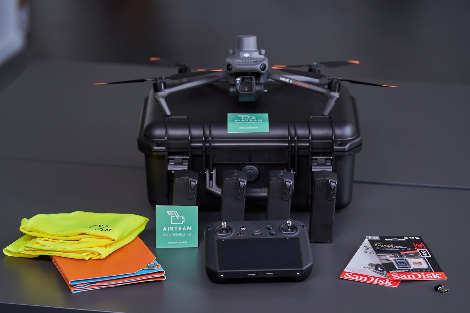
The DJI Mavic 3 Enterprise C1 is particularly suitable for larger or more complex objects: It supports automated flight routes and provides high-precision data.
Step 3: Upload images & let AI evaluate
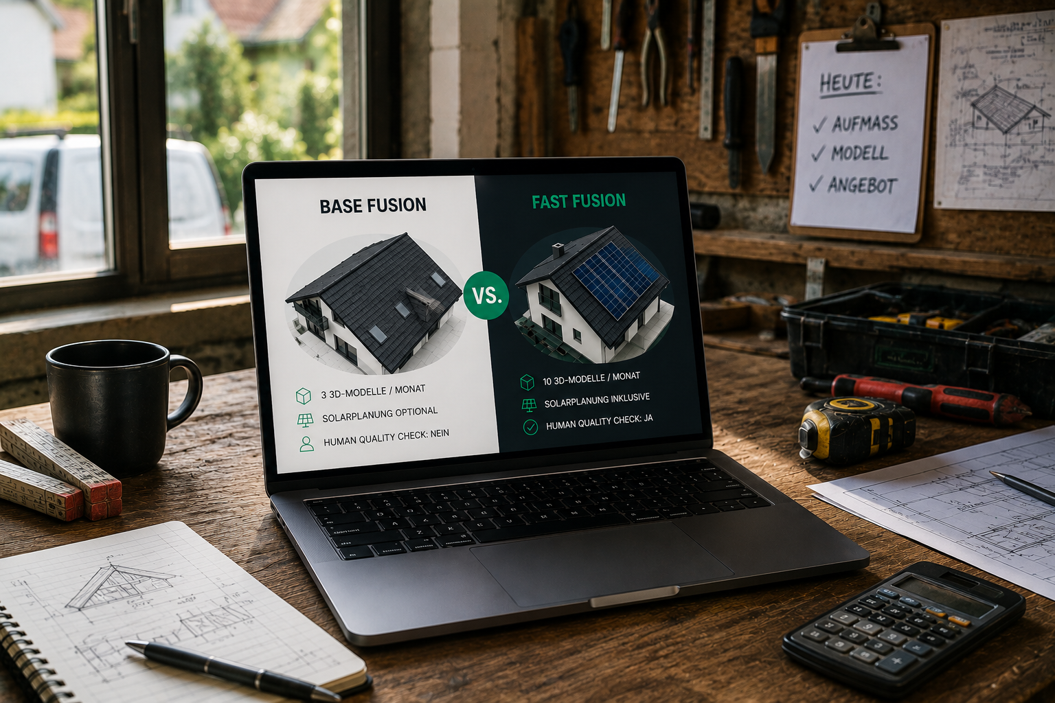
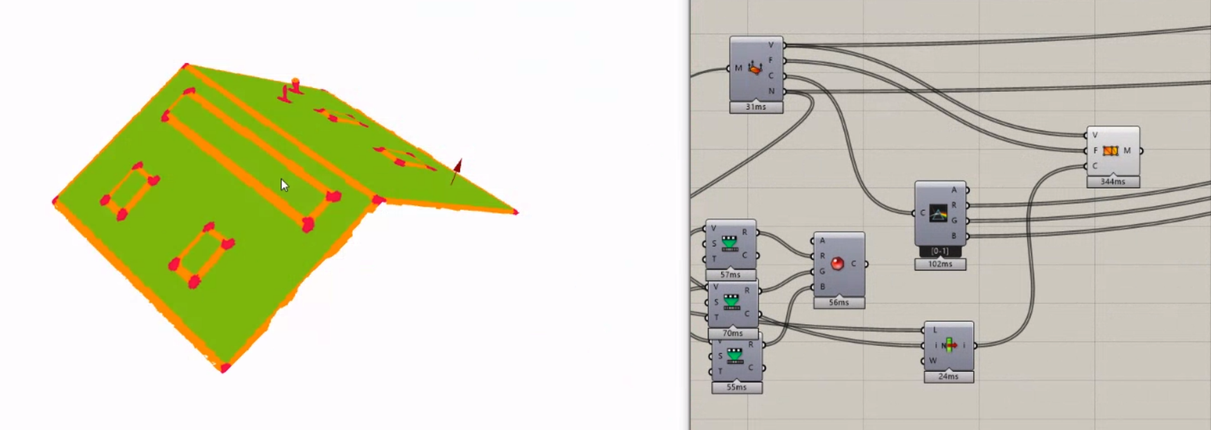
The captured images are then simply uploaded. Our AI processes the data and uses it to create an exact 3D model of the building. This saves up to 90% time compared to traditional measurement. You can output data in over 25 different formats, including GLB, DXF/DWG, OBJ, SKP, JSON and IFC.

Step 4: Use & export a 3D model
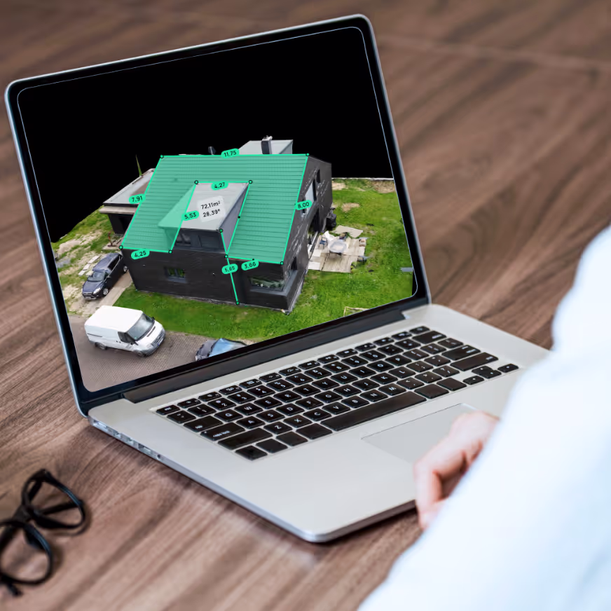
As soon as the evaluation is complete, the interactive model is available on the platform. You can:
- Measure lengths, areas, heights and roof slopes directly,
- Analyze roof areas, identify obstacles and plan modules,
- create DIN-compliant measurement reports,
- Export data to common formats such as PV*sol, SketchUp or AutoCAD.
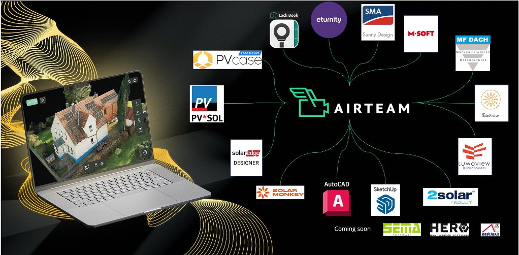
Step 5: Software integrations
The captured 3D models can be easily integrated into existing tools and work processes. The Airteam platform supports over 25 common file formats for direct connection to planning systems, ERP and quotation software.
In this way, error-prone double entries are avoided and the digital workflow in the company is sustainably accelerated
Who is it suitable for?
✅ Roofers & Carpenters
- Create offers without roof inspection
- Precisely measure complex structures such as dormers
- Use data for construction site planning and documentation
✅ Solar Installers
- Plan PV systems digitally and precisely
- Optimally determine module surfaces and orientation
- Use impressive visualizations for customer conversations
✅ Scaffolders & Real Estate Professionals
- Determine façade dimensions and building heights quickly and easily in 3D
- High-resolution data for offers, marketing & documentation
Common questions
Do I need a special drone or license?
No The Platform works with common drone models. No special license is required for small drones under 250 g. Alternatively, you can book a pilot at any time.
How accurate are the measurement data?
The AI-based evaluation provides centimeter-accurate values and is up to 8x more precise than Google Maps. The data is DIN-compliant and suitable for professional use.
How long does the entire process take?
- Flight time: about 3-15 minutes
- 3D data delivery: within 24 hours
Conclusion: Accurate building data in less than 24 hours
3D measurement with drone and AI is the fastest, safest and most accurate method for all craft businesses that depend on reliable building data. No risk, no CAD knowledge, no additional effort.
Now Test for free & start your first project!