Drone measurement vs. laser scan: Which technology provides the most precise roof measurement?


Drone measurement vs. laser scan: Which technology provides the most precise roof measurement?
Digital measurement is revolutionizing roof measurement through precise planning with reduced workload on the roof. Modern technologies document the smallest deformations with maximum precision and replace risky manual methods. This comparison shows you which measurement technology is optimal for your projects.
The 5 most important technologies for digital roof measurement
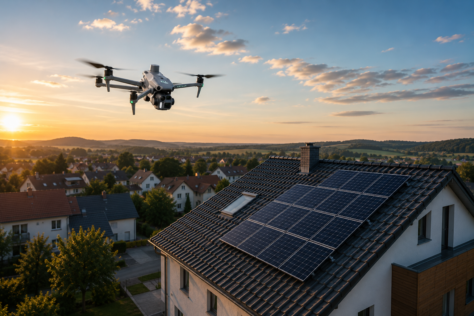
Drone photogrammetry: The precision champion
Photogrammetric measurement with high-resolution cameras on UAVs offers the highest quality performance with detailed RGB information to detect the smallest stains. This technology achieves horizontal accuracy of up to 1 cm, with vertical accuracy typically being half to a third as good.
Professional drone photogrammetry with ground control points achieves an accuracy of ~3 cm with RTK workflows. This is the preferred solution for precise solar system planning and DIN-compliant measurements.
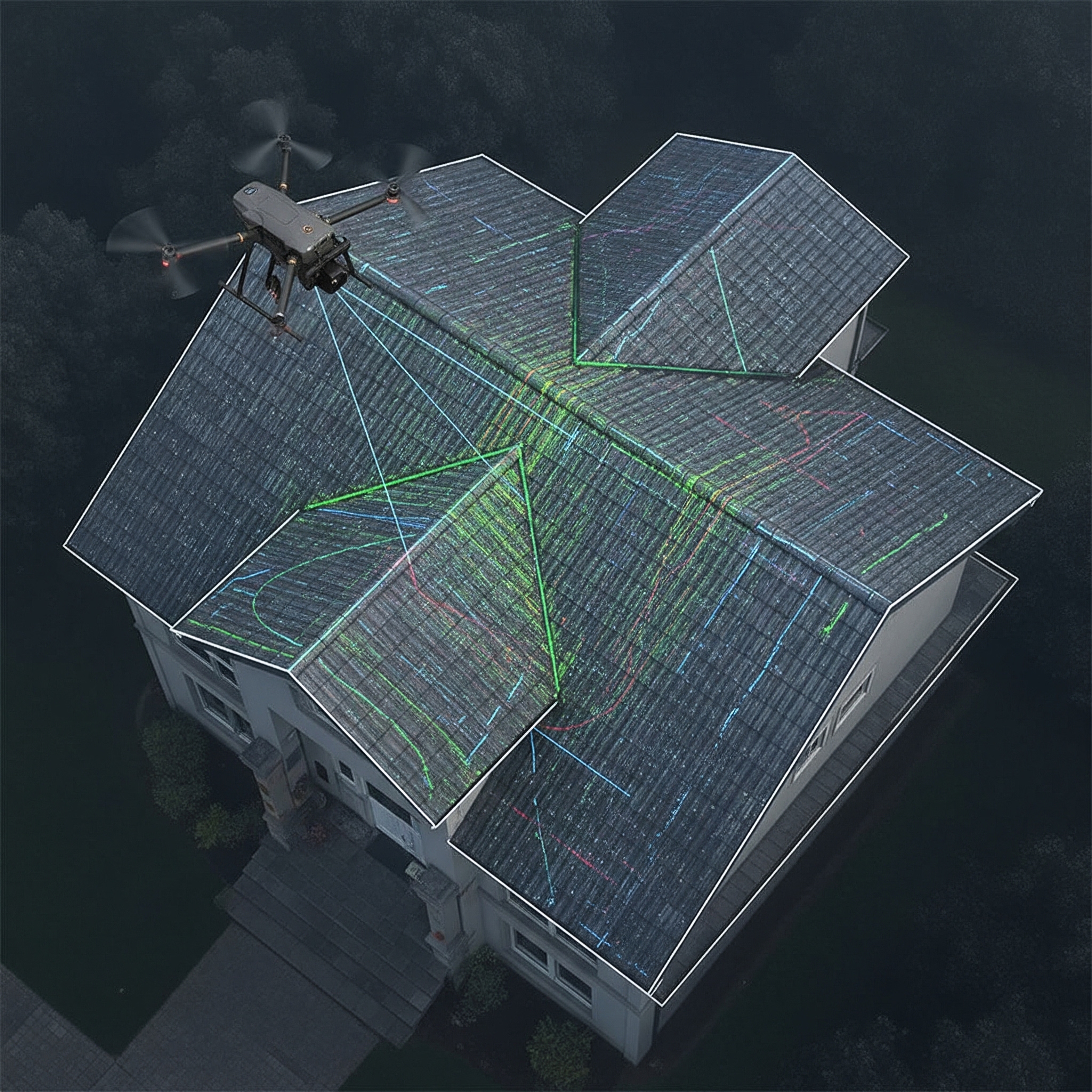
Drone LiDAR: Speed Meets Efficiency
UAV lidar captures 3D geometry very quickly and provides ~1—5 cm absolute accuracy in practice; ±5 cm is usual as a guideline, with GCPs ~3 cm is possible. ~ 20-30% sidelap is often sufficient for data collection. Photogrammetry requires significantly more overlap (approx. 80% /70% front/side) and is texture-dependent, but also reaches centimeters on suitable surfaces.
Terrestrial laser scanning: millimetre precision
Terrestrial laser scanners, which are placed in multiple positions, generate highly accurate 3D information without the need for a flight license or permits. This technology achieves single-point accuracy at mm levels and below, with the measurement of millions of points in minutes.
Millimeter range accuracy is the typical standard for high-precision AEC applications such as structure assessments. This is the ideal solution for critical renovation projects with the highest accuracy requirements.
Horizontal stand positioning
Horizontal stands allow façade scans from open windows or with an arm extended outwards. Don't scan through glass. The data quality meets the TLS specifications in the millimeter range (at ~10 m). Photogrammetry supplemented with very good textures, but in practice it usually achieves lower geometric accuracy.
Cost comparison: What does which technology cost?
Operational costs per project
Drone roof inspections cost between €80-150 per hour of flight time, while traditional methods cost €75-200 per inspection. However, investment costs differ significantly between technologies.
Hardware investment: LiDAR vs. photogrammetry
Professional LiDAR sensor systems cost €45,000-270,000, while photogrammetry only requires a professional drone with camera for €1,800-4,500. The overall system costs, including training and annual software, vary accordingly.
Cost estimate of the total investment:
- LiDAR system: €67,500-315,000
- Photogrammetry system: €2,700-7,200
- Difference in ± 20% equipment costs: ±€13,500-63,000
Processing time: Who delivers faster?
Raw lidar data requires just a few minutes of calibration to generate the final point cloud, while photogrammetry processing can take ten times longer than the survey itself. Individual laser scans take 1.5-7 minutes, with 64-150 typical scans per day.
Calculating and analyzing photogrammetry data is more time-consuming and requires strong computing resources compared to laser scanning. Processing time is becoming a critical factor for commercial businesses, as faster turnaround times enable more projects per day.
German legislation for drone surveying
Registration and licensing
Germany requires operator registration for drones over 250g or with cameras, plus an EU drone license that is recognized between countries. UAVs weighing 5kg or more require an ascent permit plus UAV operator license.
Insurance and operating regulations
Liability insurance is mandatory for private and commercial drone flights with at least €750,000-900,000 coverage. The operating regulations include a 120m height limit without special permit, visual connection required, and 50m distance from uninvolved persons.
Commercial drone operations are primarily used for surveying/measurement (79%), followed by inspection activities (53%) in Germany.
Weather dependency: When can you fly?
LiDAR: The all-weather champion
As an active sensor, LiDAR generates its own light and is unaffected by clouds and changing lighting conditions, including absolute darkness, in contrast to the passive camera sensor used in photogrammetry. LiDAR works well in most weather conditions, although heavy rain or fog can affect laser pulses.
Photogrammetry: Depending on the weather, but of high quality
Strong winds can significantly knock drones off course and make control difficult, while rain can damage drone equipment, leading to higher inspection costs. Drone operations cannot fly in bad weather conditions, such as strong wind or heavy rain.
Weather dependency creates operational restrictions that influence project planning and completion deadlines.
When to choose LiDAR over photogrammetry?
LiDAR is suitable for narrow objects such as transmission lines, pipes, sharp edges, roof edges, and building corners with which photogrammetry has difficulties. Mobile laser scanners are suitable for more affordable but rough 3D planning, with the advantage of combining roof scans with interior building scans.
LiDAR is preferred when operational efficiency is more important than visual documentation. Projects that require fast turnaround times, consistent weather-independent operation, or integration with interior building scans benefit from LiDAR's speed and reliability advantages.
Key Takeaways
- Photogrammetry offers the highest accuracy with up to 1 cm horizontal precision for DIN-compliant measurements
- LiDAR processes data up to 10x faster than photogrammetry, ideal for time-critical projects
- Traditional manual inspections pose significant safety risks, while digital methods eliminate personnel exposure to hazardous conditions
FAQ
What is the accuracy of drone photogrammetry for roof measurements? Professional drone photogrammetry achieves horizontal accuracy of up to 1 cm, with vertical accuracy typically half to a third as good.
How high are the costs for drone surveying in Germany? Drone roof inspections cost €80-150 per hour of flight time, while traditional methods cost €75-200 per inspection.
What insurance do I need for commercial drone flights? Liability insurance is mandatory with at least €750,000-900,000 coverage for all private and commercial drone flights.
When is LiDAR better than photogrammetry? LiDAR is preferred for fast turnaround times, weather-independent operation and for narrow objects such as roof edges where photogrammetry has difficulties.
Digital roof measurement with Airteam: Precision meets speed
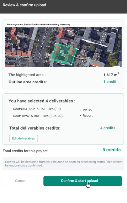
Modern measurement technology eliminates safety risks and provides DIN-compliant accuracy. Airteam combines AI photogrammetry with 24-hour delivery for 90% faster project delivery. The Airteam Fusion platform automatically converts drone images into precise 3D building models and AI-generated planning data — exportable to over 20 file formats for seamless integration into your existing workflows.
sources:
- https://www.laserscanning-europe.com/en/roof-survey-comparison-different-technologies-capturing-inaccessible-roof-areas-inspection (accessed on 02.09.2025)
- https://www.bluefalconaerial.com/drone-roof-inspection/ (accessed on 02.09.2025)
- https://www.sciencedirect.com/science/article/abs/pii/S0926580521000029 (accessed on 02.09.2025)
- https://www.mdpi.com/1424-8220/22/1/265 (accessed on 02.09.2025)
- https://enterprise-insights.dji.com/blog/lidar-equipped-uavs (accessed on 02.09.2025)
- https://wingtra.com/lidar-drone/lidar-vs-photogrammetry-what-sensor-to-choose/ (accessed on 02.09.2025)
- https://www.propelleraero.com/blog/drone-surveying-misconceptions-lidar-vs-photogrammetry/ (accessed on 02.09.2025)
- https://roofclaim.com/drone-roof-inspection-cost/ (accessed on 02.09.2025)
- https://www.angi.com/articles/drone-roof-inspection-cost.htm (accessed on 02.09.2025)
- https://skykam.co.uk/cost-drone-roof-inspection-cost/ (accessed on 02.09.2025)
- https://en.hsd-services.de/post/3d-mapping-with-drones-photogrammetry-versus-lidar-3d-laser-scanning (accessed on 02.09.2025)
- https://www.pointscan.co.uk/a-guide-to-3d-laser-scanning/ (accessed on 02.09.2025)
- https://drone-traveller.com/drone-laws-germany/ (accessed on 02.09.2025)
- https://www.flyeye.io/german-drone-basic-rules/ (accessed on 02.09.2025)
- https://www.lexology.com/library/detail.aspx?g=cfc3615a-37a8-45f3-892e-a46f0ce10865 (accessed on 02.09.2025)
- https://www.gsourcedata.com/lidar-vs-photogrammetry-choosing-the-right-aerial-survey-tech-for-your-project/ (accessed on 02.09.2025)
- https://www.haart.co.uk/buying/buying-advice/should-you-get-a-drone-roof-survey/ (accessed on 02.09.2025)
- https://www.thefullview.co.uk/blog/roof-inspection-cost-guide (accessed on 02.09.2025)
https://www.jouav.com/blog/lidar-vs-photogrammetry.html (accessed on 02.09.2025)