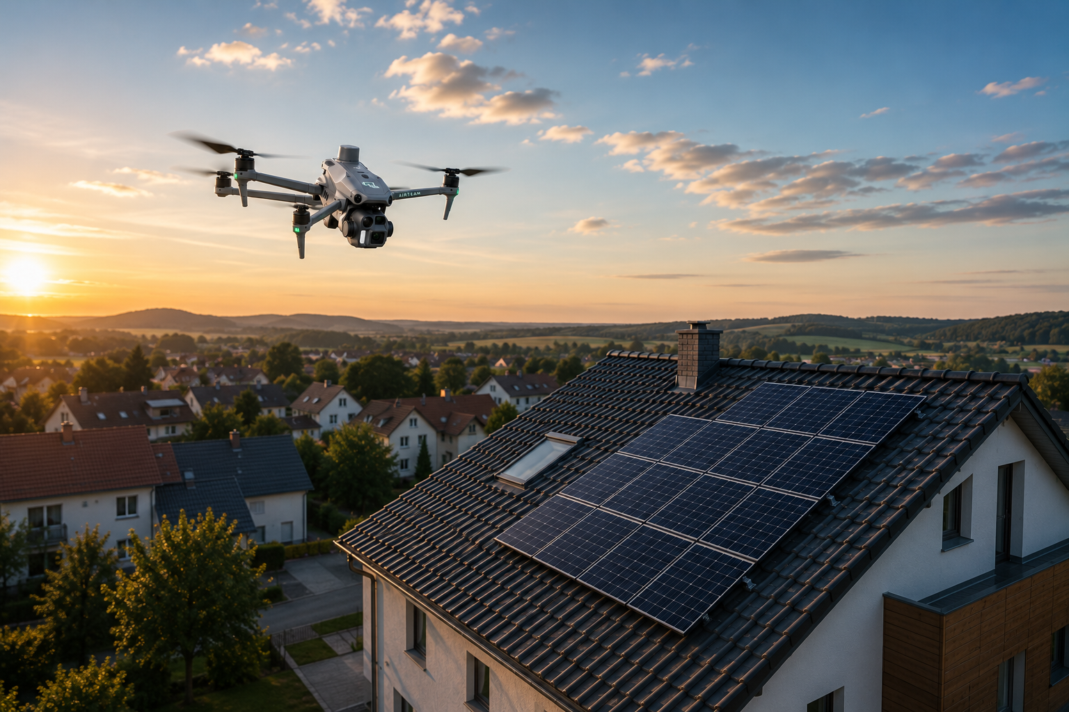
Drones for photovoltaic systems: first measure then plan


Optimum efficiency of photovoltaic systems on the roof and open-space systems requires proper planning. Professional drone pilots create high-resolution aerial images of roofs and surfaces, from which software calculates exact dimensions and topology. Distances, areas and angles can be determined in this way without anyone having to climb onto the roof or manually measure the area. Find out now how drones simplify, speed up and make the planning of photovoltaic systems cheaper.
Photovoltaic systems are getting cheaper & better
Investing in a photovoltaic system pays off in several ways: The environment benefits, the owner is independent of the public power grid and over the years, the wallet is relieved or fuller. Photovoltaic systems, together with wind turbines, play a key role on the path to sustainable living.
Facilities on the roof and on the ground

Converting sunlight into electricity and installing a photovoltaic system is equally worthwhile for private homeowners and companies of all sizes. Drones help with the cost-effective planning, implementation and maintenance of small and large projects — from private systems on the roof to photovoltaic ground-mounted systems.
The proportion of open-space systems is expected to continue to grow in the coming years. that Renewable Energy Development Act For the period from 2019 to 2021, projects with a total output of 4 gigawatts will be awarded via special tenders. Drones help to implement all these plans quickly and cost-effectively.
Using drones to measure areas for open-space systems
There are traditionally two options for measuring the area of house roofs and collecting topological information about a possible area for an open space installation: Either someone climbs onto the roof or creates a complex area survey on the ground, or data from Google Maps is used, which, however, is usually not accurate enough. With a single drone flight, all important data about roofs and open spaces can be collected — much faster and, in the case of roofs, without the risk of a crash.
Experience shows that the planning phase for photovoltaic systems with drones is reduced by up to 70 percent.
Field service engineers use images taken by drones and collected data to visualize their projects. Analyses of shadows and collection of hydrological information are also possible.
Sample visualization for zolar GmbH Here in the video:
Taken together, the data collected by drones helps to implement projects up to 90 percent faster.
Drones are the eyes of the project manager
Once the planning for the photovoltaic system on the roof has been completed or a suitable terrain for an open-space system has been found, the construction phase begins. In the case of large projects, the project manager uses the drone footage to obtain a detailed overview. Completely without ascents and long tours across the terrain. The quickly available information improves project implementation and compliance with deadlines.
Project monitoring from lofty heights requires less time, generates better reports and saves money as a result.
AIRTEAM helps with system planning
AIRTEAM Aerial Intelligence GmbH prepares professional roof and area surveys, which serve as a basis for planning photovoltaic systems and open-space systems. If you have any further questions, please call us, write to us or use the live chat. We are working on a better future with our solutions.