Drone photogrammetry software 2025: The ultimate comparison for crafts & construction


Drone photogrammetry software 2025: The ultimate comparison for crafts & construction
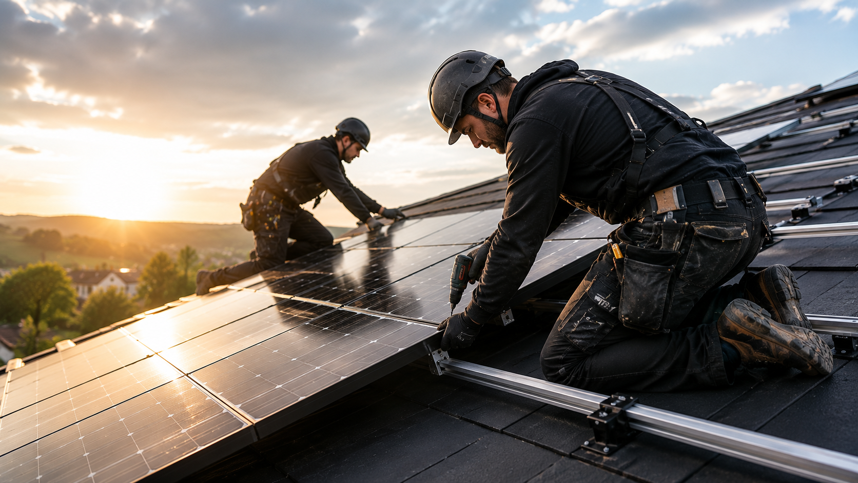
Drone photogrammetry software is revolutionizing building measurement for craft businesses and construction companies. From AI-supported masking to special industry solutions — the 2025 software landscape offers precise, time-saving tools for DIN-compliant measurements. This comparison shows you which solution is the best choice for your company.
Market overview 2025: What has changed?
New AI features and cloud platforms
The biggest innovation in 2025 is AI-based automation features that eliminate manual work steps. RealityScan 2.0 introduces major updates — from AI-powered masking and alignment improvements to visual quality verification and support for airborne laser scanning. Automatic background removal through a trained segmentation model eliminates the need to manually mask, rename, or reimport images.
Modern programs use AI photogrammetry and machine learning classification to make the process even more intelligent. The AI can automatically identify different types of objects — separate buildings from trees or differentiate equipment from permanent structures. The latest version of Agisoft Metashape 1.7 automatically recognizes power lines on images, creates better depth maps with new algorithms and can reconstruct thin structures using photogrammetry.
Important rebrands and partnerships
Key integrations — PVcase Roof Mount has introduced two major integrations: Airteam and K2 Systems (2025). These partnerships create seamless workflows from drone measurement to solar component planning.
Swiss software company Eturnity has added new features for project overview and technical design automation, specifically for small and medium-sized enterprises (SMEs) that target commercial, industrial and private solar segments.
The 8 leading photogrammetry solutions in detail
RealityScan 2.0 (formerly RealityCapture): AI-powered masking
overview: RealityScan 2.0 brings powerful new features to a renamed RealityCapture version, including AI-powered masking, alignment improvements, and visual quality verification.
Pricing model: Free for students, teachers and companies with annual sales below $1 million. In addition, the single license costs $1,250 per year. Alternatively, the Unreal subscription with Unreal Engine and Twinmotion is available for $1,850 per year.
Perfect for: craft businesses with a limited budget and a high volume of workmanship.
Agisoft Metashape: The classic with cloud processing
overview: Sophisticated desktop suite for precise photogrammetry. Cloud processing available via Agisoft Cloud.
pricing model: The Professional Edition currently costs 3,499€ for Agisoft Metashape. This desktop software is considered the gold standard for accurate photogrammetry results.
Hardware requirements: Complex geometry reconstruction algorithms in photogrammetric software require significant computing resources for optimal data processing. A high-speed multi-core CPU (6+ cores, 3 GHz+) is therefore recommended (2025).
Perfect for: Surveying professionals and technical offices with high accuracy requirements.
Pix4Dmapper: GIS integration for surveying professionals
overview
Pricing model: Pix4Dmapper for desktop PC costs €4,000 per year — without drone & without survey reports (2024).
Accuracy standards: Results with sub-centimeter accuracy thanks to photogrammetric analysis: 1-2 pixels GSD in X, Y directions, 1-3 pixel GSD in Z direction for Pix4Dmapper. Note: These specifications are based on data from 2020 and may have improved with newer software releases.
Hardware resources: The largest set we've tested so far consisted of over 2600 images (~10MB each) and this project peaked at around 20GB of memory for Pix4D (2022) during processing.
Perfect for: GIS professionals and surveying offices with complex mapping requirements.
DroneDeploy: Focus on construction site management
overview: DroneDeploy is a cloud-based reality capture platform that automates drone flights and processes images into maps and 3D models. You'll appreciate the simple, integrated workflow that reduces field time and provides shareable insights without advanced GIS expertise (2024).
Pricing model: Individual (Construction) at 349.00€ per month. Advanced (Construction) at €649.00 per month for DroneDeploy (2025).
Perfect for: Construction companies with large construction sites and team collaboration.
3DF Zephyr: Automatic Reconstruction
overview: Automated photogrammetry pipeline with a user-friendly interface for medium-sized projects.
Pricing model: Free for private use up to 50 photos. Lite as a permanent license 199€ plus VAT Professional as a monthly subscription 250€ plus VAT or as a permanent license 4,200€ plus VAT 12 months of updates included in each case, extension 20% per year.
Perfect for: Smaller craft businesses with occasional 3D needs.
DJI Terra: Hardware-Software Integration
overview: Seamless integration with DJI drones for optimized workflows, particularly with standardized measurement routines.
pricing model: Pro as an annual subscription per device approx. 1,400—1,540 $; Pro as a perpetual license approx. 4,000—4,400 $ plus optional 440 $ /year for updates. Electricity as an annual license approx. 2,800-3,080 $ per device. Agriculture as an annual license of 300 $ for up to 3 devices. Bundles: Terra Standard+ DJI Modify $2,780/year, Terra Pro+ DJI Modify $2,040/year. Net prices, vary from region to region.
Perfect for: Operations with DJI hardware and regular routine measurements.
Specialized Building Solutions: Airteam Fusion Platform
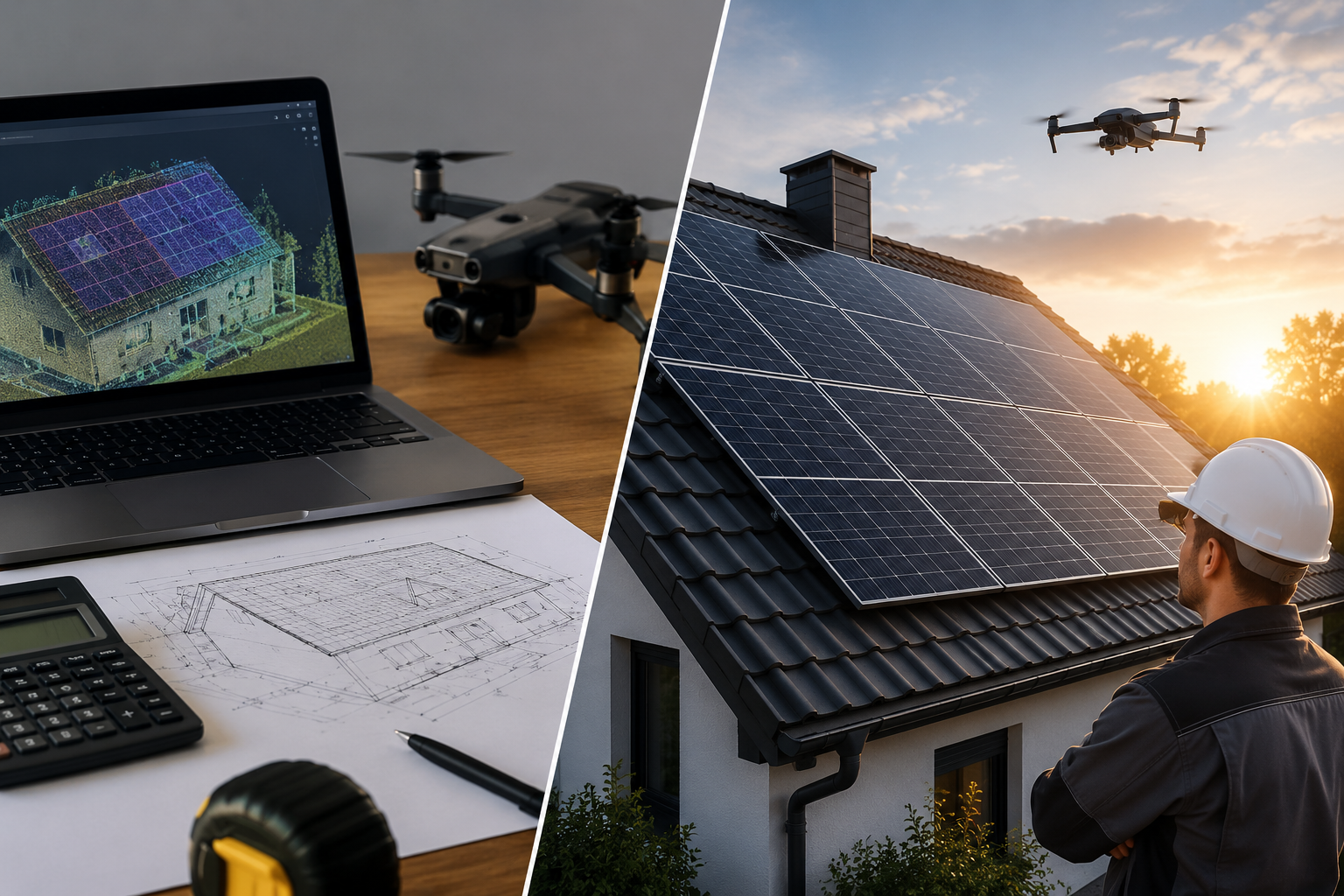
overview: Solution developed specifically for craft businesses with automatic, DIN-compliant building models and AI-generated planning data. No CAD skills required.
Pricing model: Flat rates from 125€/month (Fast Fusion) to 4,167€/month (Ultra). Eturnity Solar Expert integrates with: Airteam Fusion Platform, bexio, Microsoft Dynamics 365, Pipedrive, Sage 100 Contractor, and Salesforce (2025).
Accuracy: For building measurements, accuracy in photogrammetry depends heavily on image quality, ground control points, and processing methodology. With proper flight planning, adequate image overlap, and ground control points, the combination provides sufficient accuracy for most construction and renovation applications.
Perfect for: German craft businesses (roofer, solar installers, carpenter, scaffolders).
3Dsurvey and OpenDroneMap: Emerging Young Companies
overview: Open-source alternative for budget-conscious teams with technical expertise.
3Dsurvey pricing model: Subscription 225 €/month or 2,250 €/year. Permanent license 3,399€; updates/support optional 610 €/year. Prices usually plus VAT
OpenDronemap/webODM pricing model: ODM open source for free.
Perfect for: Startups and experimental projects with limited budgets.
Especially for craft businesses: Which software for which sector?
What is the best drone photogrammetry software 2025 for craft businesses? DroneDeploy for construction site workflows, RealityScan 2.0 for high-speed processing, and specialized solutions such as Airteam for building-specific measurements. The choice depends on industry requirements, budget, and integration requirements.
Roofers: DIN-compliant measurements & MF roof export
The achievable photogrammetry accuracy depends on accessibility, texture, GSD, and RTK/GCP. For building measurements in 1:50, the required display accuracy is usually ±2—2.5 cm.
recommendation: Airteam Fusion platform for automatic DIN-compliant measurements with direct MF roof export.
Try Airteam for free: 90% faster from drone flight to finished measurement — without CAD knowledge. Test now for 14 days without obligation.
Solar installers: PV*SOL, Eturnity & PVcase integrations
Which photogrammetry software is best for solar system planning? Eturnity and PVcase offer dedicated solar planning integrations, while general photogrammetry tools such as Pix4D provide the 3D data that can be exported to solar design software. Eturnity software supports installers and sellers of climate-friendly building technologies (photovoltaics/solar, heat pumps, charging stations, e-mobility, etc.).
Solar planning requires specialized workflows that general photogrammetry software cannot directly provide. Dedicated solar software such as Eturnity or PVcase offers automatic module placement, shading analysis and direct integration with component databases.
Carpenter: SEMA & CAD export for timber construction
Hardware considerations: It's best to have eight cores and 16 threads or more. Thirty-two gigabytes of RAM or more. Single or multiple GPUs with 8 gigabytes of video memory on each GPU. With these specifications, you can confidently process 2,000 thousand photos at once (2024).
What is the best surveying software for carpenters?
Airteam for DIN-compliant roof measurement with MF roof and clean SEMA export. Metashape Pro if you want to reconstruct yourself and need flexible CAD exports. 3DF Zephyr for small projects at a good price. RealityScan for quick scans. OpenDroneMap for tech-savvy teams with a small budget.
recommendation: Agisoft Metashape or Airteam for precise roof geometry with SEMA/Sketchup/AutoCAD export.
Scaffolders: Facade measurement & Scaffmax integration
Which survey software is best for scaffolding planning?
Airteam with Scaffmax integration is the best pragmatic choice for scaffolders. For millimetre cases, add TLS. If you want to reconstruct yourself: Pix4Dmapper or Metashape. Small budget: 3DF Zephyr or OpenDroneMap.
recommendation: Airteam for façade measurement with Scaffmax integration.
Cost-benefit analysis 2025
Comparing licensing models
How much does professional drone survey software cost in 2025? The prices range from free (RealityScan for companies <€1 million revenue) to €649€/month (DroneDeploy Advanced). Perpetual licenses cost 3,499-4,990 € for professional software.
Price comparison 2025:
- RealityScan 2.0: Free for companies <€1 million in revenue
- DroneDeploy: $349-649 /month
- Pix4Dmapper: €4,000/year
- Agisoft Metashape: 3,499€ (perpetual)
- Airteam: 125-4,167€/month (depending on package)
Hidden costs: hardware, training, support
Assumptions:
10-person craft business works on 50 projects/year
€400/month software subscription
€15,000 hardware investment
40h training for €50/h = €2,000
30% increase in efficiency = €24,000/year
Formula: Total 3-year TCO = (software + training + hardware) - efficiency savings; Calculation: (€400×36 + €2,000 + €15,000) - (€24,000×3) = €31,400 - €72,000 = -€40,600 (net savings)
Sensitivity: +/ -20% for efficiency increases → -€26,000 to -€55,200 net result.
ROI calculation for SMEs
Assumptions:
Desktop workstation vs. cloud processing comparison
€3,000 local hardware costs
€0.50/hour cloud processing
100 hours processing/month;
Formula: Break-even time = hardware costs/(monthly cloud costs × 12)
Calculation: €3,000/(€50 × 12) = 5 years break-even
Sensitivity: +/ -25% processing time → 4-6.25 years break-even period.
Integration & workflow efficiency
New partnerships: PVcase & Eturnity
Key integrations — PVcase Roof Mount has introduced two major integrations: Airteam and K2 Systems (2025). These partnerships enable seamless workflows from precise building measurement to automated solar component selection.
15+ export formats: From DXF to BIM
What new features do photogrammetry programs offer in 2025? AI-powered masking, automatic background removal, improved alignment algorithms, Airborne laserscan support, and advanced cloud processing capabilities are the most important 2025 updates across all major platforms.
Automation vs. manual post-processing
The 2025 updates focus heavily on automation and AI-controlled processing to reduce manual intervention. These improvements address the biggest pain points in photogrammetry workflows: time-consuming manual masking, alignment corrections, and object classification.
Conclusion: The right choice for your company
Decision matrix by sector and company size
Cloud-based software such as DroneDeploy processes data on remote servers and offers convenience and collaboration features, but requires Internet connectivity. Desktop applications such as Pix4D and Agisoft Metashape process data locally, offer more control and privacy, but require powerful hardware (2025).
Recommendation matrix:
- Roofing contractor (2-20 employees): Airteam Fusion Platform
- Solar installers (5-50 employees): Airteam+Eturnity integration
- Large construction companies (50+ employees): DroneDeploy Advanced
- Surveying offices: Agisoft Metashape Professional
- Budget-conscious startups: RealityScan 2.0 or OpenDroneMap
Ready for DIN-compliant drone measurement? Book a personal demo and find out how over 5,000 craft businesses save time with Airteam.
sources:
- https://www.maplibrary.org/9620/7-best-drone-mapping-software-options/ - (accessed 09.09.2025)
- https://www.realityscan.com/en-US/news/realityscan-20-new-release-brings-powerful-new-features-to-a-rebranded-realitycapture - (accessed 09.09.2025)
- https://sourceforge.net/software/product/Eturnity-Solar-Expert/ - (accessed 09.09.2025)
- https://www.airteam.ai/en/blog/comparing-drone-photogrammetry-software-2024 - (accessed 09.09.2025)
- https://www.saasworthy.com/product/dronedeploy/pricing - (accessed 09.09.2025)
- https://www.unrealengine.com/en-US/blog/we-are-updating-unreal-engine-twinmotion-and-realitycapture-pricing-in-late-april - (accessed 09.09.2025)
- https://solarbuildermag.com/news/solar-storage-software-showcase-2025/ - (accessed 09.09.2025)
- https://www.pv-magazine.com/2025/05/09/eturnity-adds-more-pv-design-automation-energy-system-project-control-to-its-software/ - (accessed 09.09.2025)
- https://www.dronedeploy.com/blog/photogrammetry-software-complete-guide-for-accurate-3d-mapping-and-reconstruction - (accessed 09.09.2025)
- https://www.pix-pro.com/blog/photogrammetry-pc - (accessed 09.09.2025)
- https://www.agisoft.com/downloads/system-requirements/ - (accessed 09.09.2025)
- https://www.pugetsystems.com/solutions/photogrammetry-workstations/pix4d/hardware-recommendations/ - (accessed 09.09.2025)
- https://www.buildingconservation.com/articles/photogram/photogrammetry.htm - (accessed 09.09.2025)
- https://www.sciencedirect.com/science/article/abs/pii/S0305440316000042 - (accessed 09.09.2025)
https://nerdisa.com/dronedeploy/ - (accessed 09.09.2025)