Drone Measurement for Roof Measurements and Solar Systems — Advantages over Manual Measurement


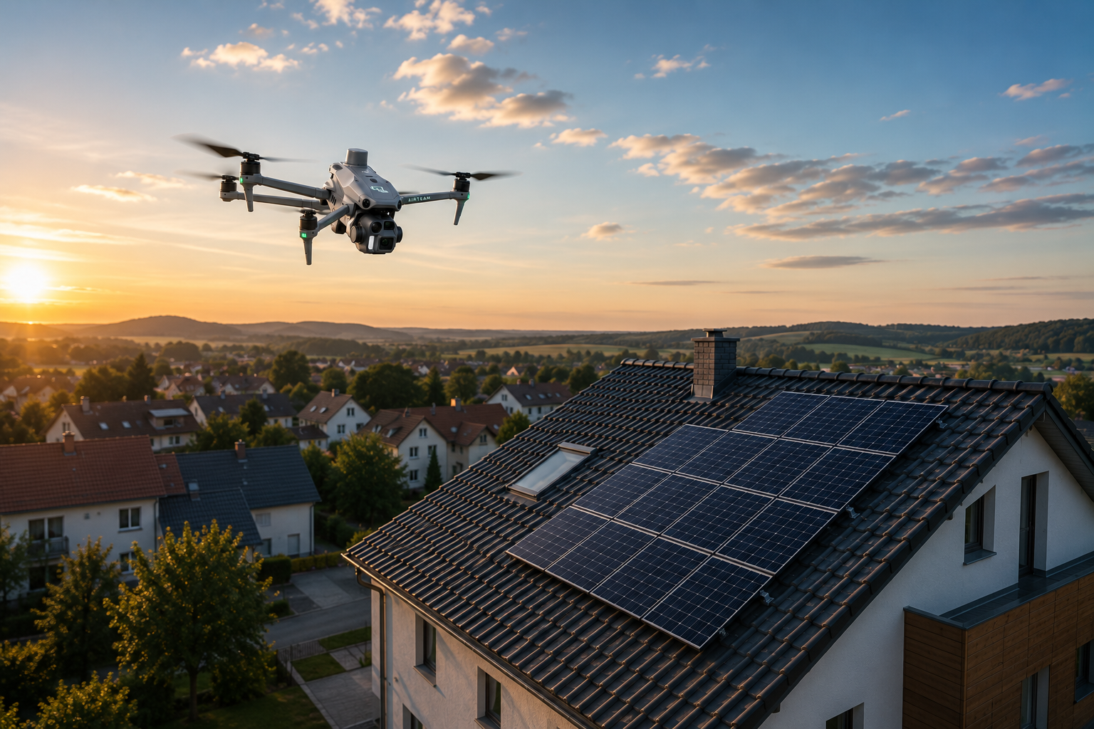
Digitalization is revolutionizing crafts — and drone surveying is at the forefront of this. While traditional measurement methods take hours or days, modern AI photogrammetry delivers precise 3D models within 24 hours. For roofers, solar installers, carpenters and scaffolders, this means DIN-compliant precision without wires, 90% time savings and significantly fewer additions.
How does drone measurement work?
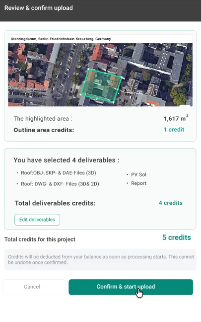
Drone surveying uses AI-based photogrammetry to create 3D models down to the centimeter from overlapping aerial images. Die Airteam Fusion platform These processes drone recordings fully automatically in the cloud — the user does not need any CAD expertise or expensive software licenses.
The decisive difference to conventional methods: Instead of measuring individual points manually, the drone captures the entire object in a short flight. During data evaluation, the AI automatically recognizes roof areas, dormers, throats and ridges, calculates slopes and generates all relevant planning data.
Benefits of drone measurement with Airteam
Highest DIN-compliant precision
Up to 99.9% accuracy - Drone Surveyor 8x more accurate than satellite measurement and eliminates the typical sources of error associated with manual measurements.
Each 3D model undergoes automatic quality control. The result: reliable measures for VOB-compliant offers, precise material orders and zero percent planning errors due to digital precision.
Massive time savings — 90% faster
Time is money — especially in crafts. Drone measurement reduces time spent on roof measurements by up to 90%:
- 3D model in 24 hours Instead of days of evaluation
- Detailed planning data within 2-7 working days Depending on the size of the project
- A short drone flight Replaces hours of manual measurements
- Instant cloud availability — Teams access data from anywhere
Significant cost savings
Drone surveying lowers costs on several levels:
- Reduced personnel costs — One drone pilot instead of several specialists
- No scaffolding or lifts Required for measurement
- Avoiding expensive rework Through precise initial measurement
- Flat rates starting at 125€/month — calculable costs instead of variable expenses
Gewobag achieves 40% cost savings in basic analysis. Lumoview Building Analytics even achieved a 90% cost reduction compared to alternative methods.
Maximum Safety — Measuring from the Ground
Safety comes first — Not just empty phrases, but daily reality on construction sites. Drone surveying eliminates the biggest risks:
- No Dangerous Ladders Or roof inspections
- Identification of hard-to-reach areas Such as Throats, Dormers, Ridge
- Drastic Reduction of Accidents at Work
Every avoided accident not only saves human suffering, but also downtime, insurance costs and image damage.
Diverse data formats for every process
Compatibility is decisive for practicality. Airteam delivers 15+ file formats and integrates seamlessly into existing workflows:
- Direct export with PV*SOL, Eturnity, MF Roof, SEMA, SketchUp, AutoCAD
- BIM-compatible models for modern planning processes
- CSV exports For Your Own Calculations
- DXF/DWG for CAD applications
No media breaks, no manual transfers — the data flows directly into your systems.
Practical solar system planning
Especially for solar installers, Airteam offers significant added value:
- In-software module configuration Optimized for maximum yield
- Automatic preview Identifies suitable areas
- Visual planning Perfect for presentation to customers
- Direct integration at SolarEdge Designer, Sunny Design, PVCase
Pro Electrify AG reduced measurement errors by 92% and increased the completion rate by 38%. Svea Solar reduced planning time by 48% while increasing yield by 15%.
Disadvantages of manual measurement
High security risks
Manual roof measurement means risk of falling. Wet Bricks, Icy Surfaces, Rotten Rafters: The risks are real and the consequences are often dramatic. Accidents at work lead to downtime, insurance claims and, in the worst case, permanent health damage.
Time-time-consuming processes
Manually measuring a complex roof takes hours or even days:
- Effort and preparation
- Rise and secure
- Point-by-point measurement
- Manual documentation
- Transfer to planning software
- Bug correction and post-processing
Time when there is no productive work. Time that customers have to wait. Time that costs money.
Susceptibility to errors
People make mistakes — especially when pressed for time, in bad weather, or in difficult positions. Typical problems of manual measurement:
- Measurement error Due to inaccurate tools or reading
- Estimations for inaccessible areas
- Inconsistent documentation Between Different Fitters
- Transmission error From Paper to Digital Systems
Any mistake can result in costly rework, incorrect material orders, or unprofitable offers.
Limited data quality
Manual measurement only provides what the fitter sees and measures:
- 2D measurements only Without spatial connections
- Incomplete recording Areas that are difficult to see
- No visualization for customer presentations
- Missing additional data Such as Thermography or Shading
Modern projects need more — they need complete, digital twins.
Practical examples of success
Dachdeckerei Harnack Achieves 100% accuracy and 0% rework with Airteam. 1Komma 5° Reduced measurement errors by 91% and reduced project costs by 24%. Energieinsel Saves 87% time and works 100% with 3D models.
These figures are no exceptions — they are the new standard for digitized craft businesses.
It works so easily
The path to drone measurement is easier than expected:
- Drone flight — Fly yourself or book a pilot
- upload — Load images into the Airteam Fusion platform
- Conceiving — Retrieve 3D model and planning data
Starter sets are available from 1,950€ including drone, training and a 2-month flat rate. Alternatively, use the Airteam pilot network for professional flying without your own drone.
Conclusion: The future is digital
Drone measurement is not a dream of the future — it is already a reality for over 5,000 companies today. The benefits are measurable: more security, massive time savings, higher precision and better data quality.
While the competition is still climbing ladders, digitized companies are already winning the next order. With precise 3D models, professional visualizations and DIN-compliant dimensions.
Ready for 90% faster measurements? Try Airteam for free and see how drone surveying is revolutionizing your craft.